MA203D_V01_DhadingPopulation_A3-300dpi.jpeg
From the dataset abstract
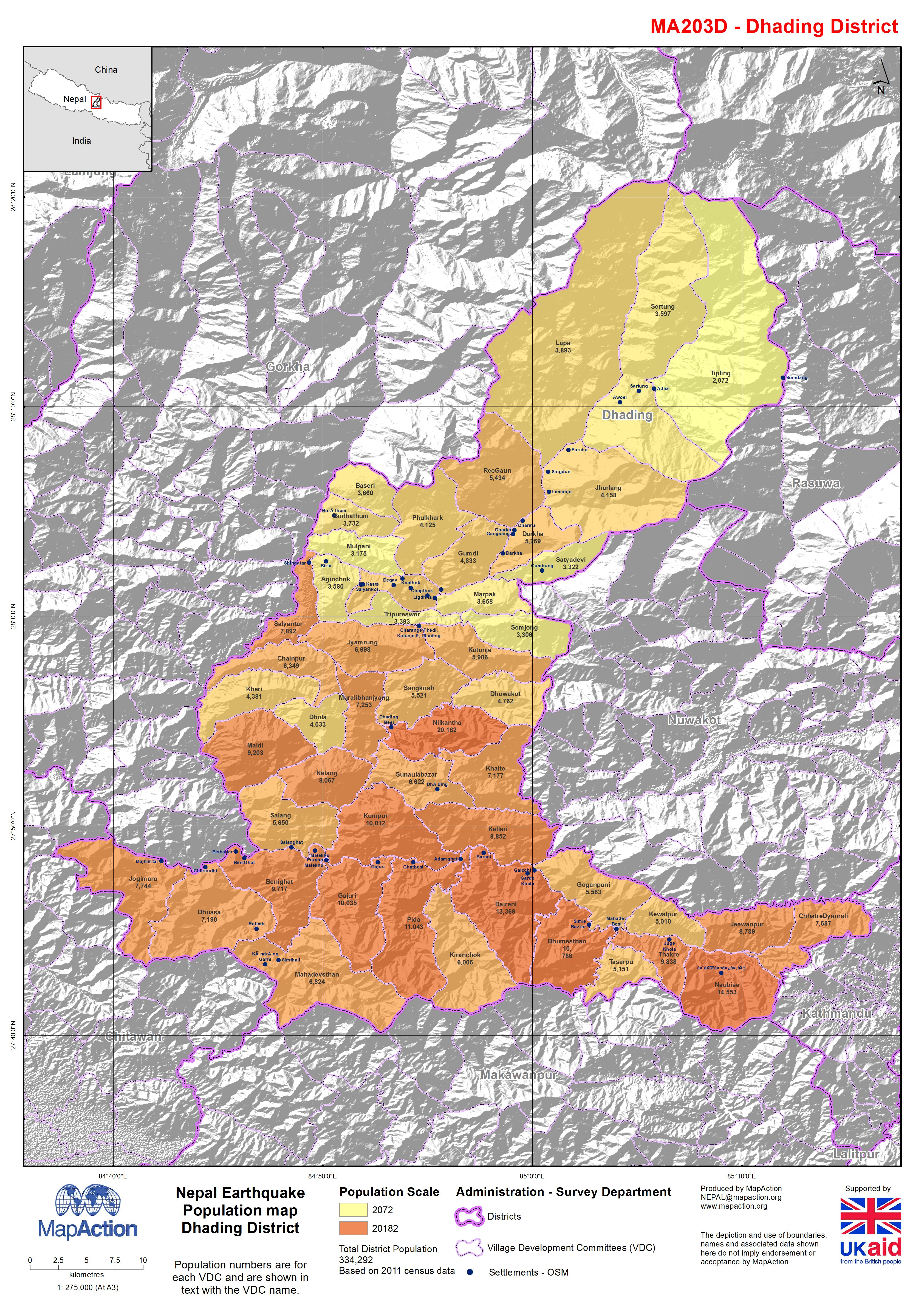
Map shows population by Village Development Communities, hill shaded relief and some settlement information.
Additional Information
| Field | Value |
|---|---|
| Data last updated | July 4, 2016 |
| Metadata last updated | July 4, 2016 |
| Created | July 4, 2016 |
| Format | JPEG |
| License | License not specified |
| Has views | True |
| Id | 036fc3cc-7c29-4caf-96d3-d7ed1f88feb7 |
| On same domain | True |
| Package id | 83ae67dc-de66-4c51-bac7-fbd83ede094d |
| Revision id | d0209eda-70b6-4dea-a815-51518e25e09d |
| State | active |
| Url type | upload |