MA0011_Chikwawa_District_Sites_v3-300dpi.jpeg
From the dataset abstract
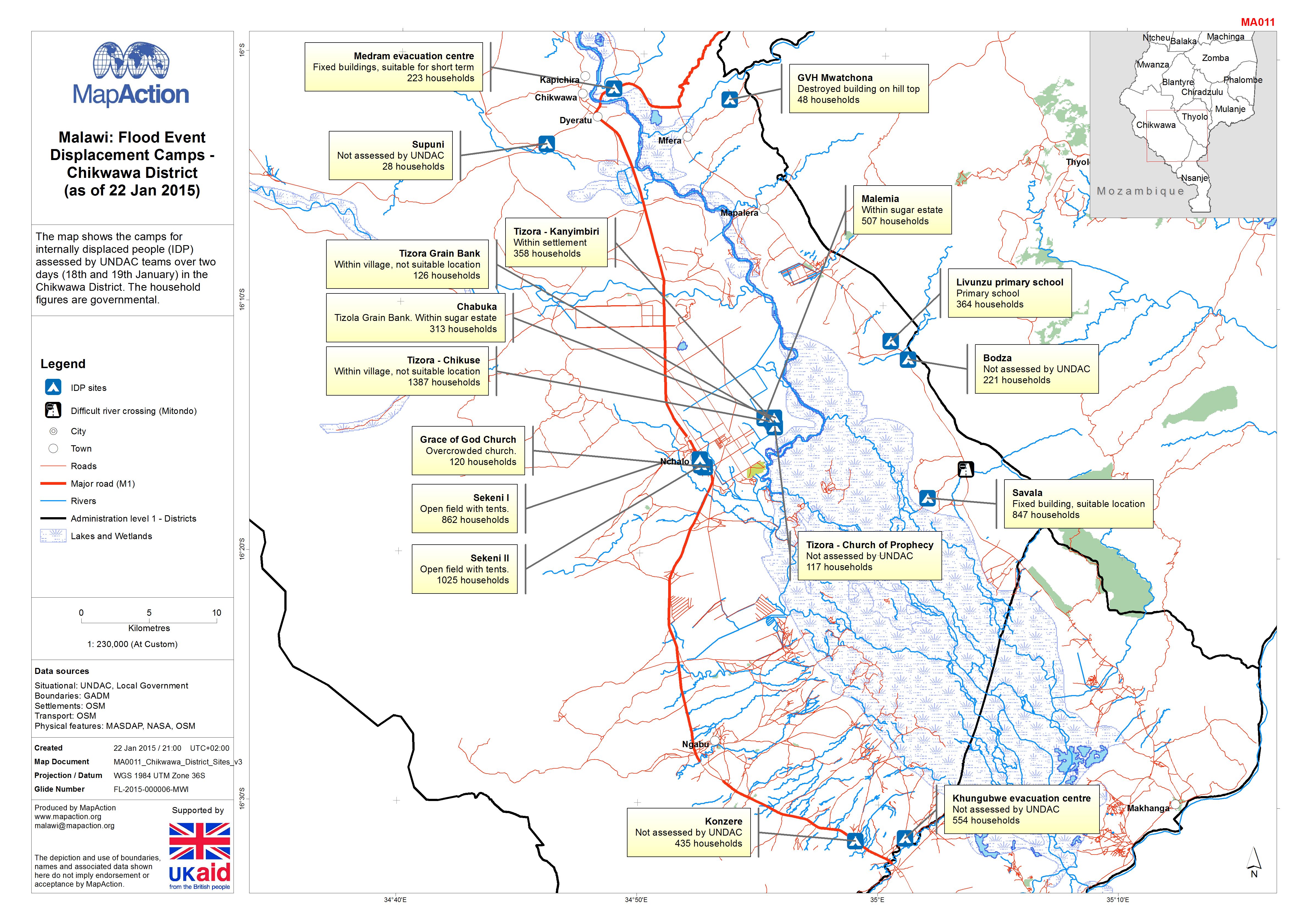
The map shows the camps for internally displaced people (IDP) assessed by UNDAC teams over two days (18th and 19th January) in the Chikwawa District. The household figures are governmental.
Source: Malawi: Floods - Displacement Camps - Chikwawa District (as of 22 Jan 2015)
Additional Information
| Field | Value |
|---|---|
| Data last updated | July 4, 2016 |
| Metadata last updated | July 4, 2016 |
| Created | July 4, 2016 |
| Format | JPEG |
| License | License not specified |
| Has views | True |
| Id | 1994b70e-5bdd-4039-aa3b-19a6b8d42393 |
| On same domain | True |
| Package id | 015c5921-cc9e-4e58-936a-4b3bc5aa2331 |
| Revision id | a7a46929-814a-4cbb-9be4-0fc8fefd7077 |
| State | active |
| Url type | upload |