MA009_Assessment_NE_Bangula_Situational_V3-300d ...
From the dataset abstract
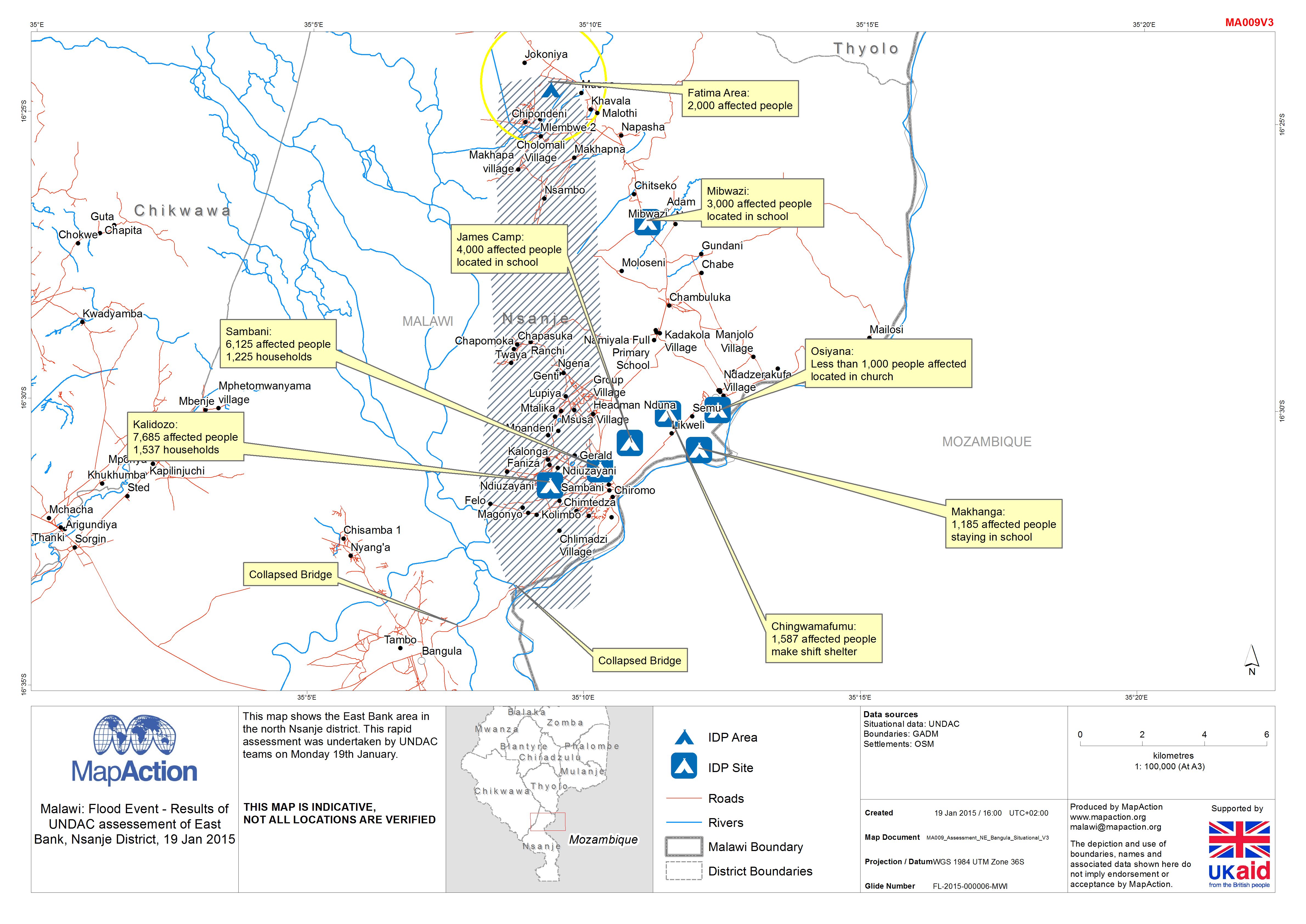
This map shows the East Bank area in the north Nsanje district. This rapid assessment was undertaken by UNDAC teams on Monday 19th January.
Source: Malawi: Floods - Results of UNDAC assessement of East Bank, Nsanje District, 19 Jan 2015
Additional Information
| Field | Value |
|---|---|
| Data last updated | July 4, 2016 |
| Metadata last updated | July 4, 2016 |
| Created | July 4, 2016 |
| Format | JPEG |
| License | License not specified |
| Has views | True |
| Id | 8ba51679-61c9-4270-a451-db3118a73f8f |
| On same domain | True |
| Package id | d3b5dc63-26ec-471e-8a86-90f3ec7f650a |
| Revision id | b880b8db-6131-4701-9423-c9022b8c22f9 |
| State | active |
| Url type | upload |