MA014_PopulationDensity-300dpi.jpeg
From the dataset abstract
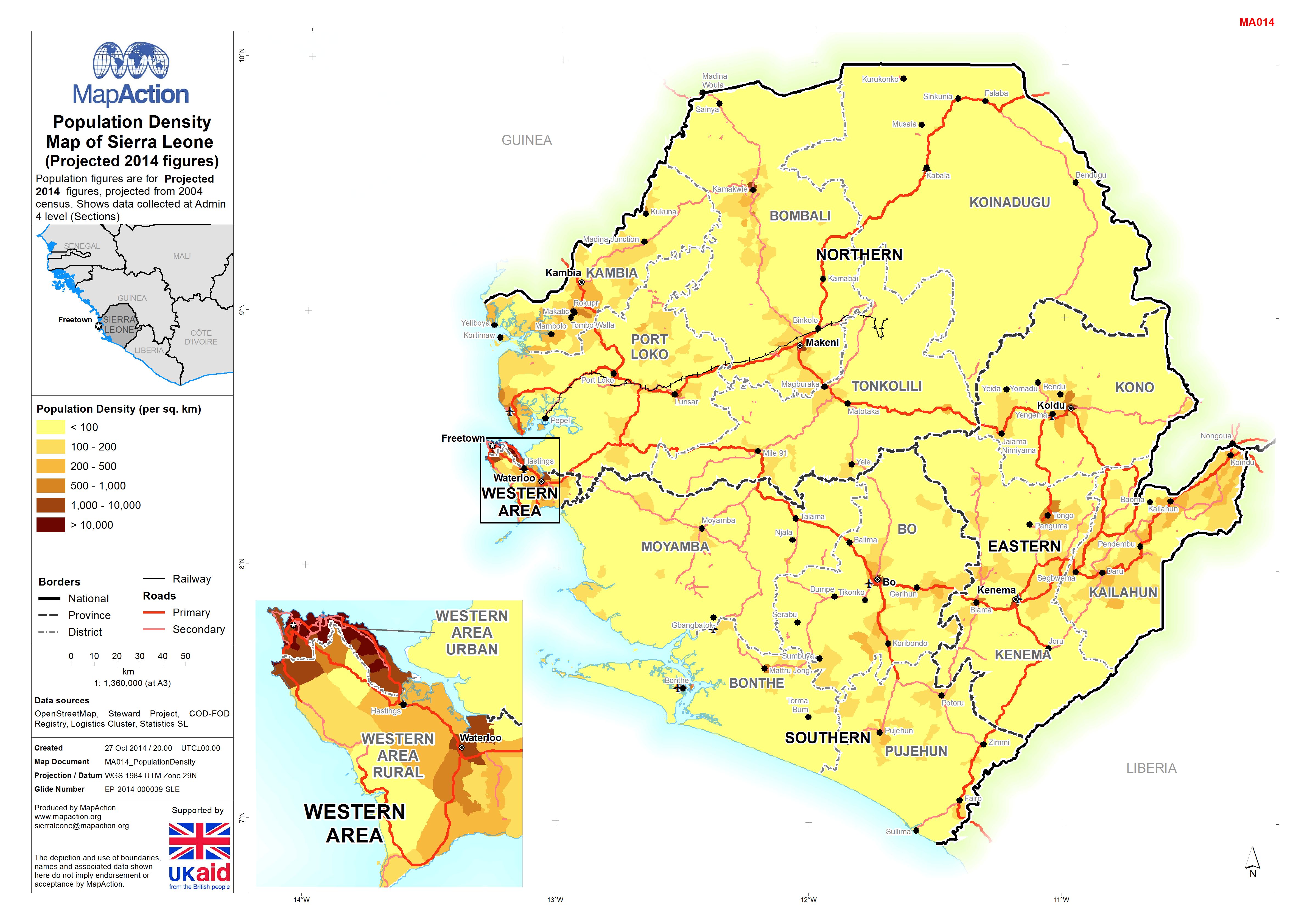
Population figures are for Projected 2014 figures, projected from 2004 census. Shows data collected at Admin 4 level (Sections)
Additional Information
| Field | Value |
|---|---|
| Data last updated | July 4, 2016 |
| Metadata last updated | July 4, 2016 |
| Created | July 4, 2016 |
| Format | JPEG |
| License | License not specified |
| Has views | True |
| Id | 707d779c-d4db-4b8d-9a86-55fe911e43be |
| On same domain | True |
| Package id | 7b4201d0-dfec-4474-8618-288c9d4ff97e |
| Revision id | 8f66ce04-e164-475f-9ec0-8f395a6f0275 |
| State | active |
| Url type | upload |