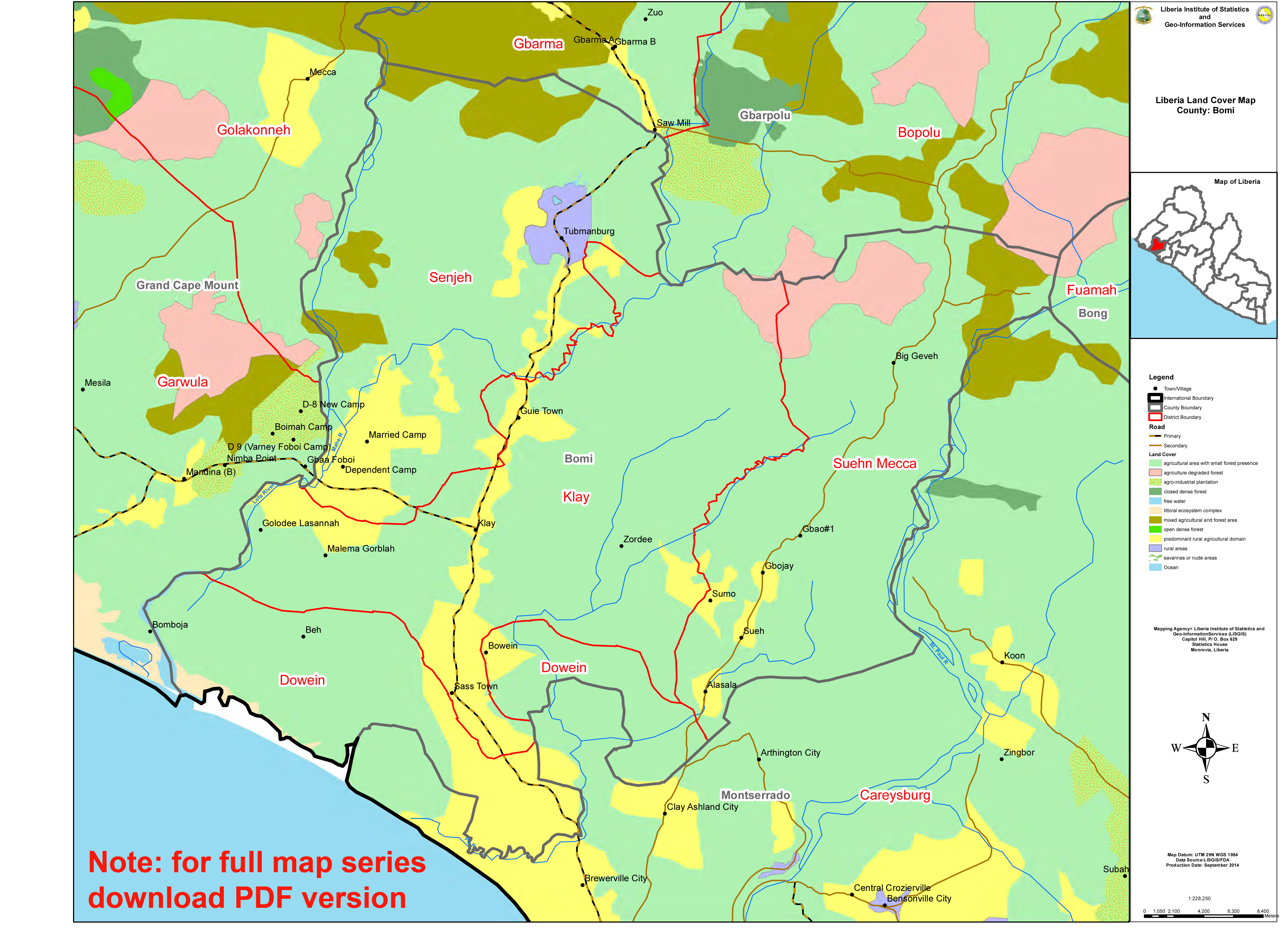
15 Counties Land Cover Map_A3_Compressed.jpg
From the dataset abstract
Atlas of land cover by county. Produced by LISGIS
Additional Information
| Field | Value |
|---|---|
| Data last updated | July 4, 2016 |
| Metadata last updated | July 4, 2016 |
| Created | July 4, 2016 |
| Format | JPEG |
| License | License not specified |
| Has views | True |
| Id | f5b5e01c-6e75-4436-9eb5-2deac9161fac |
| On same domain | True |
| Package id | 5bd88d11-a67d-4129-ba45-fee5d3b9250f |
| Revision id | cd4be82a-82cc-4eb0-8285-1203aaee1ed2 |
| State | active |
| Url type | upload |
