thumbnail.png
From the dataset abstract
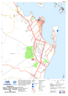
Map shows Tacloban City and near area. Infrastructure, major transport terminals, buildings and major types of land use are shown for reference.Please be advised that datasets may not be...
Source: Philippines Typhoon Haiyan (Yolanda) Infrastructure - Tacloban City (as of 10 Nov 2013)
Additional Information
| Field | Value |
|---|---|
| Data last updated | July 28, 2016 |
| Metadata last updated | July 28, 2016 |
| Created | July 28, 2016 |
| Format | PNG |
| License | License not specified |
| Has views | True |
| Id | bd021f00-93a5-4e90-896e-48a31d4fd8a9 |
| On same domain | True |
| Package id | 1c407f14-d095-4cc3-9e12-68eaf55a7099 |
| Position | 2 |
| Revision id | 66669f81-1394-45bf-9b5f-4c448a3a0208 |
| State | active |
| Url type | upload |