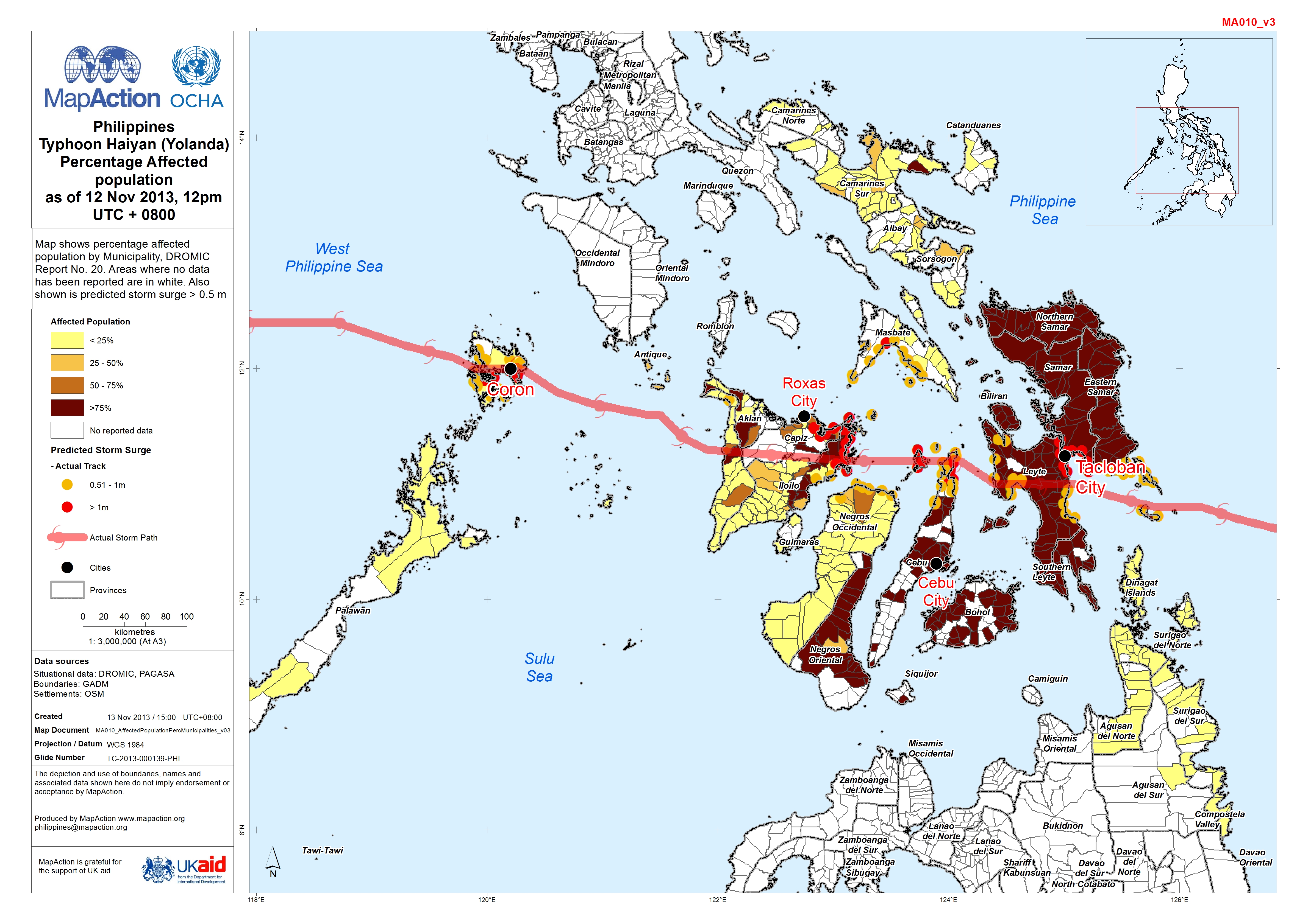
MA010_AffectedPopulationPercMunicipalities_v03- ...
From the dataset abstract
Map shows percentage affected population by Municipality, DROMIC Report No. 20. Areas where no data has been reported are in white. Also shown is predicted storm surge > 0.5 m
Additional Information
| Field | Value |
|---|---|
| Data last updated | July 4, 2016 |
| Metadata last updated | July 4, 2016 |
| Created | July 4, 2016 |
| Format | JPEG |
| License | License not specified |
| Has views | True |
| Id | 19b3f3f0-de03-4f7a-b92e-3dc199a9794d |
| On same domain | True |
| Package id | b1e5d810-c8bb-4ccb-b1eb-bd36c96d1cfd |
| Revision id | 8da2cabf-af8f-401d-9cb0-c1e208008cc0 |
| State | active |
| Url type | upload |
