MA5007_SyriaDistrictMaps_P53_Qatana.jpg
From the dataset abstract
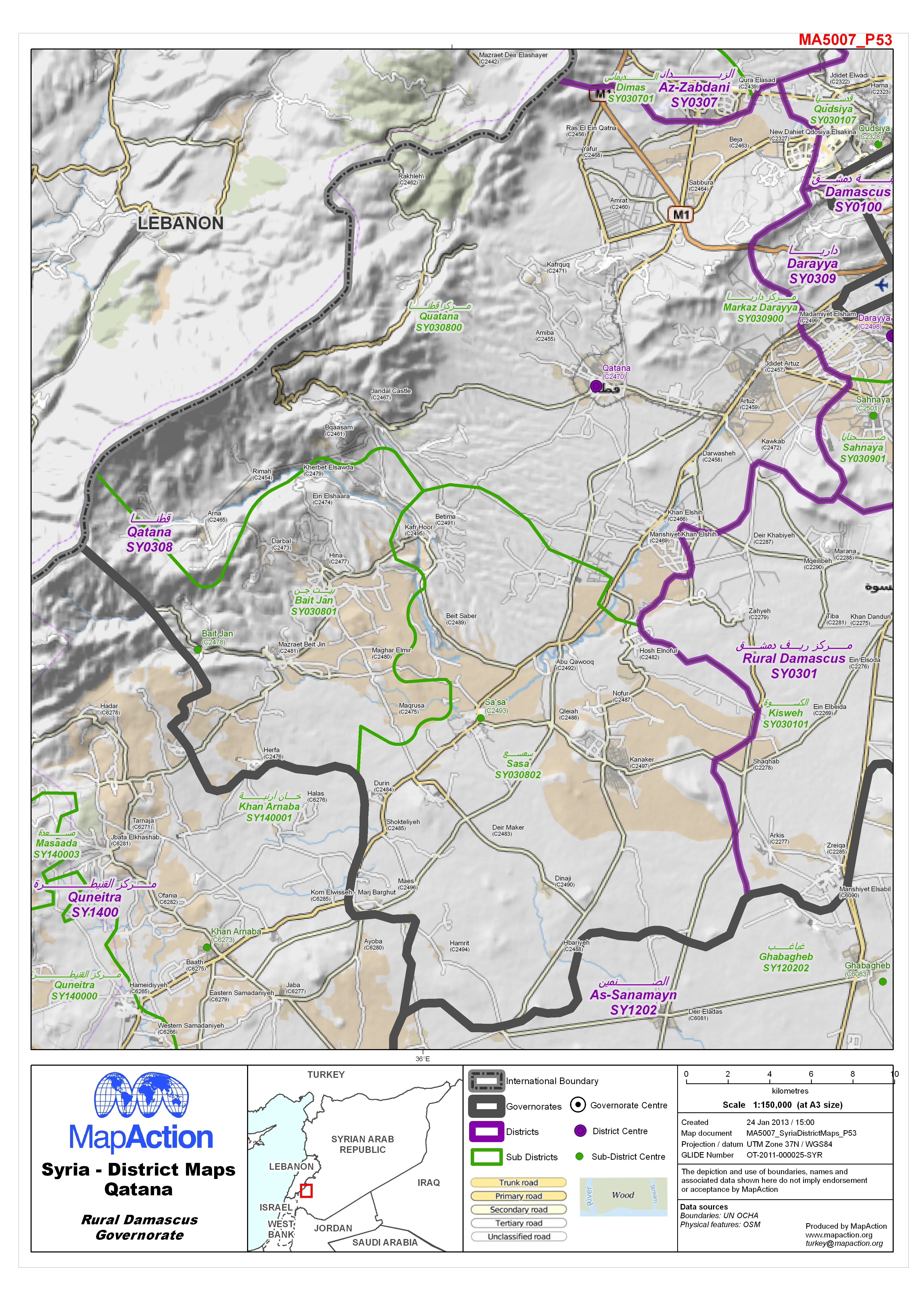
Map of Qatana District in Rural Damascus Governorate, Syria, showing sub-district boundaries over basemap (includes District and Sub-District names in English and Arabic with P-Codes)
Source: Syria - District Maps: Qatana District in Rural Damascus Governorate
Additional Information
| Field | Value |
|---|---|
| Data last updated | July 4, 2016 |
| Metadata last updated | July 4, 2016 |
| Created | July 4, 2016 |
| Format | JPEG |
| License | License not specified |
| Has views | True |
| Id | e16a578e-b455-4459-a5c8-b1b2a023e753 |
| On same domain | True |
| Package id | 03d8b92d-0b7a-4588-8261-f332b4ec121f |
| Revision id | 2c28cf3f-27c6-4383-ab17-ee0cec4ba38f |
| State | active |
| Url type | upload |