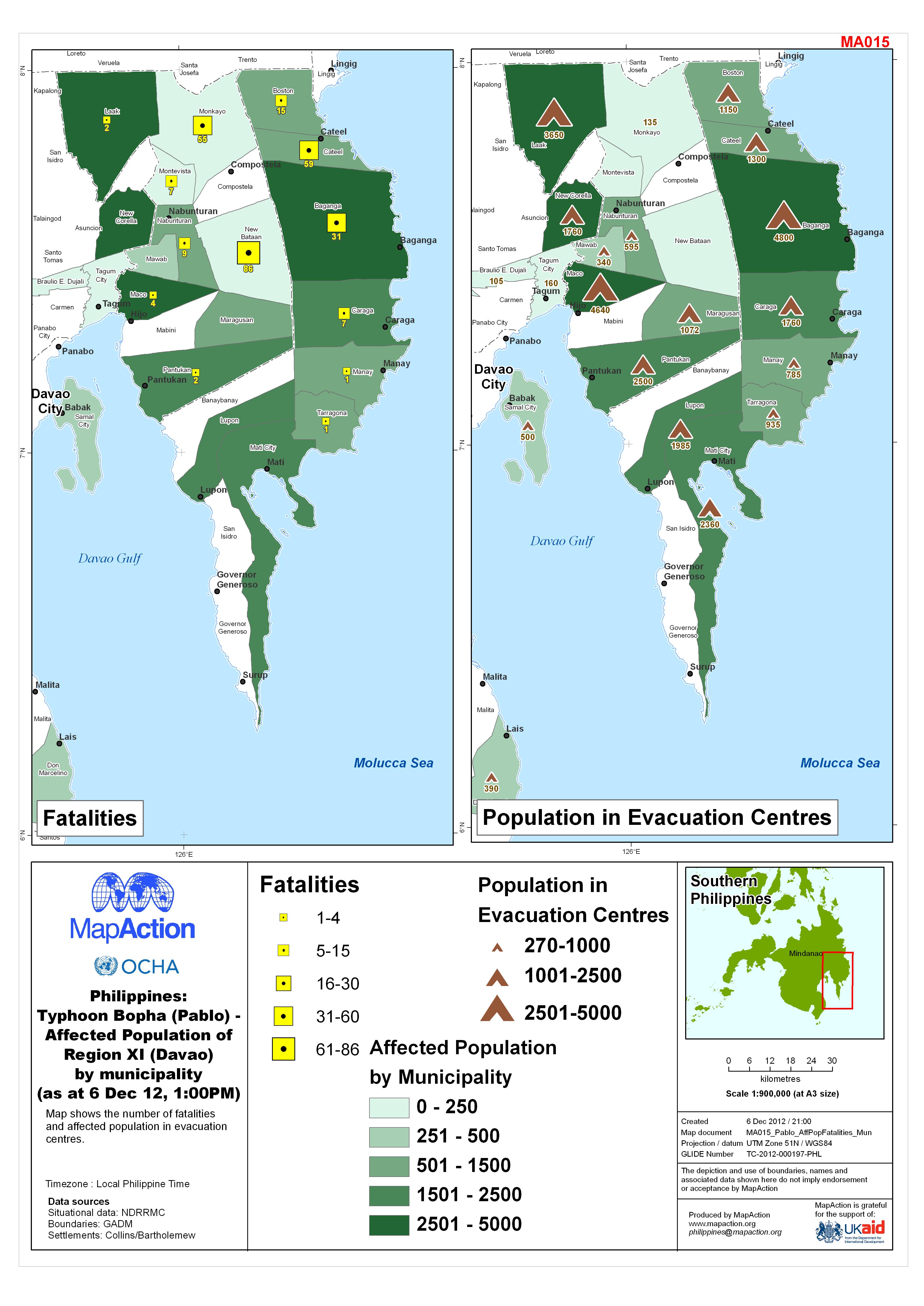
MA015_Pablo_AffPopFatalities-300dpi.jpg
From the dataset abstract
Map shows the number of fatalities and affected population in evacuation centres.
Additional Information
| Field | Value |
|---|---|
| Data last updated | July 4, 2016 |
| Metadata last updated | July 4, 2016 |
| Created | July 4, 2016 |
| Format | JPEG |
| License | License not specified |
| Has views | True |
| Id | a2159651-a316-458c-9f69-86bed4714cc0 |
| On same domain | True |
| Package id | daeefc9c-4244-48fa-95a7-eed1f5715a17 |
| Revision id | 5506f3d2-e82c-4387-97a7-74f172935f83 |
| State | active |
| Url type | upload |
