thumbnail.png
From the dataset abstract
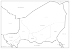
Editable PowerPoint maps illustrating level 1 administrative boundaries - click link to download - PPT002 Sahel Crisis: PowerPoint Map - Niger
Additional Information
| Field | Value |
|---|---|
| Data last updated | July 28, 2016 |
| Metadata last updated | July 28, 2016 |
| Created | July 28, 2016 |
| Format | PNG |
| License | License not specified |
| Has views | True |
| Id | b7e952ff-8973-480e-aaba-7759d2a03c97 |
| On same domain | True |
| Package id | c411c54b-15cb-4114-ae84-1b89ccc48465 |
| Position | 3 |
| Revision id | 5447870c-ceba-49aa-9950-6b63aca98ab8 |
| State | active |
| Url type | upload |