thumbnail.png
From the dataset abstract
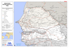
Reference map illustrating administrative boundaries, transport infrastructure and settlements.
Additional Information
| Field | Value |
|---|---|
| Data last updated | July 28, 2016 |
| Metadata last updated | July 28, 2016 |
| Created | July 28, 2016 |
| Format | PNG |
| License | License not specified |
| Has views | True |
| Id | ae121fb9-e3c9-4883-9962-cf87c7cf3c95 |
| On same domain | True |
| Package id | ac8dbb07-0c0c-403e-ad8c-b05eb3b1671a |
| Position | 2 |
| Revision id | 24b46dc3-081f-43b5-a92b-f88004807e4f |
| State | active |
| Url type | upload |