thumbnail.png
From the dataset abstract
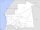
PowerPoint maps illustrating level 1 and level 2 administrative boundaries and transport links - click link to download - Sahel Crisis: PowerPoint Map Mauritania
Additional Information
| Field | Value |
|---|---|
| Data last updated | July 28, 2016 |
| Metadata last updated | July 28, 2016 |
| Created | July 28, 2016 |
| Format | PNG |
| License | License not specified |
| Has views | True |
| Id | 2fdc5416-7eb2-442e-bc85-c5555e542b7a |
| On same domain | True |
| Package id | 4a525f9b-5e98-4d05-aef2-557c408b9f46 |
| Position | 3 |
| Revision id | 7d58f25a-9172-46d2-8432-5a5ed2a4f4d0 |
| State | active |
| Url type | upload |