MA025-v03-vct-grenadines-shelter-occupancy-300d ...
From the dataset abstract
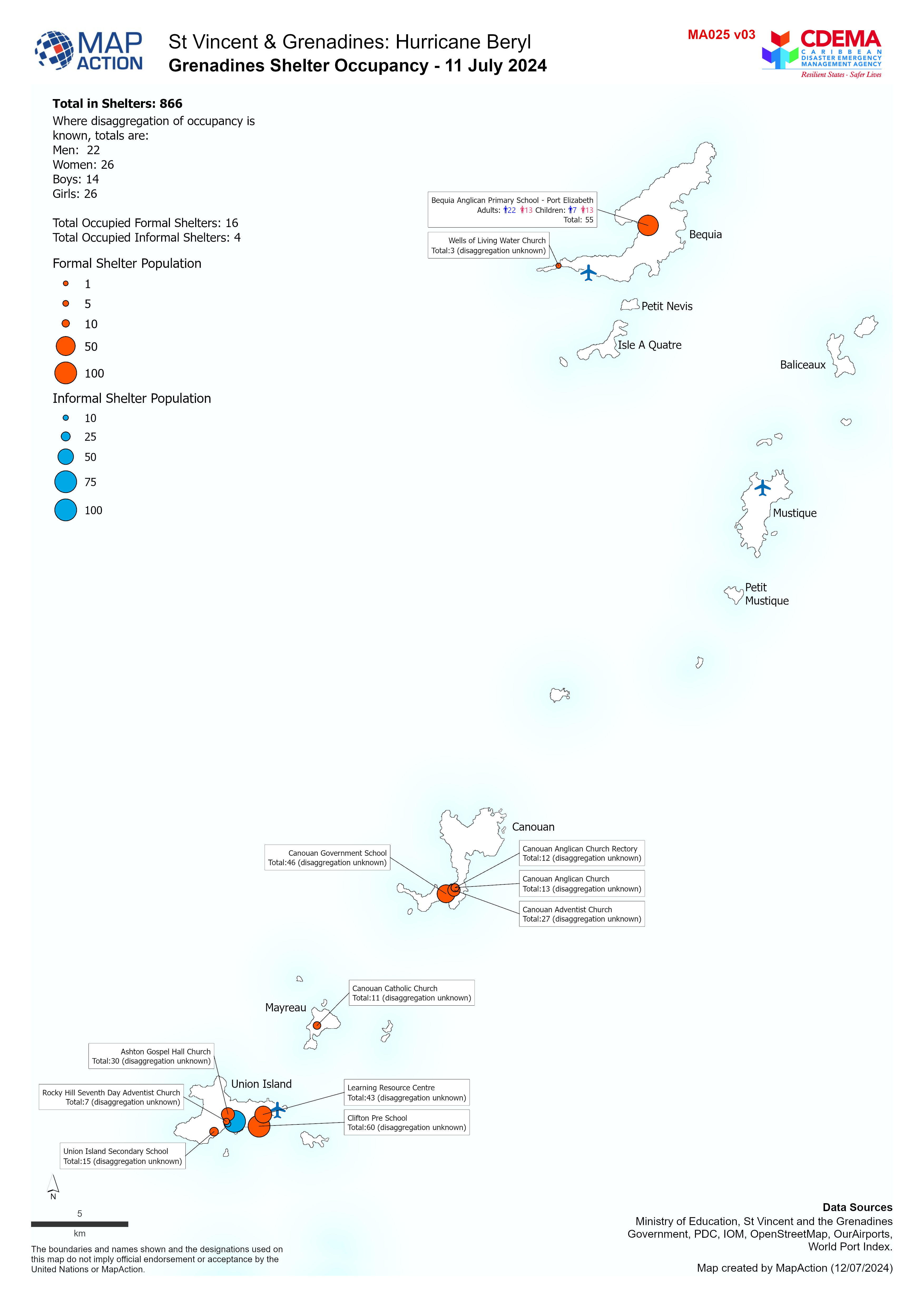
Overview map of the Grenadines showing Shelter Occupancy as of 11 July 2024.
Additional Information
| Field | Value |
|---|---|
| Data last updated | July 12, 2024 |
| Metadata last updated | July 12, 2024 |
| Created | July 12, 2024 |
| Format | JPEG |
| License | License not specified |
| Has views | True |
| Id | 87f3e650-846a-4101-b584-f392b3b6c1fd |
| Mimetype | image/jpeg |
| On same domain | True |
| Package id | 01d773e0-e6a7-4663-bb1d-d8ef0536c517 |
| Position | 1 |
| Revision id | 246f814a-6e04-4086-91d4-12560474b34e |
| Size | 995.4 KiB |
| State | active |
| Url type | upload |