MA025-v01-vct-grenadines-shelter-occupancy-300d ...
From the dataset abstract
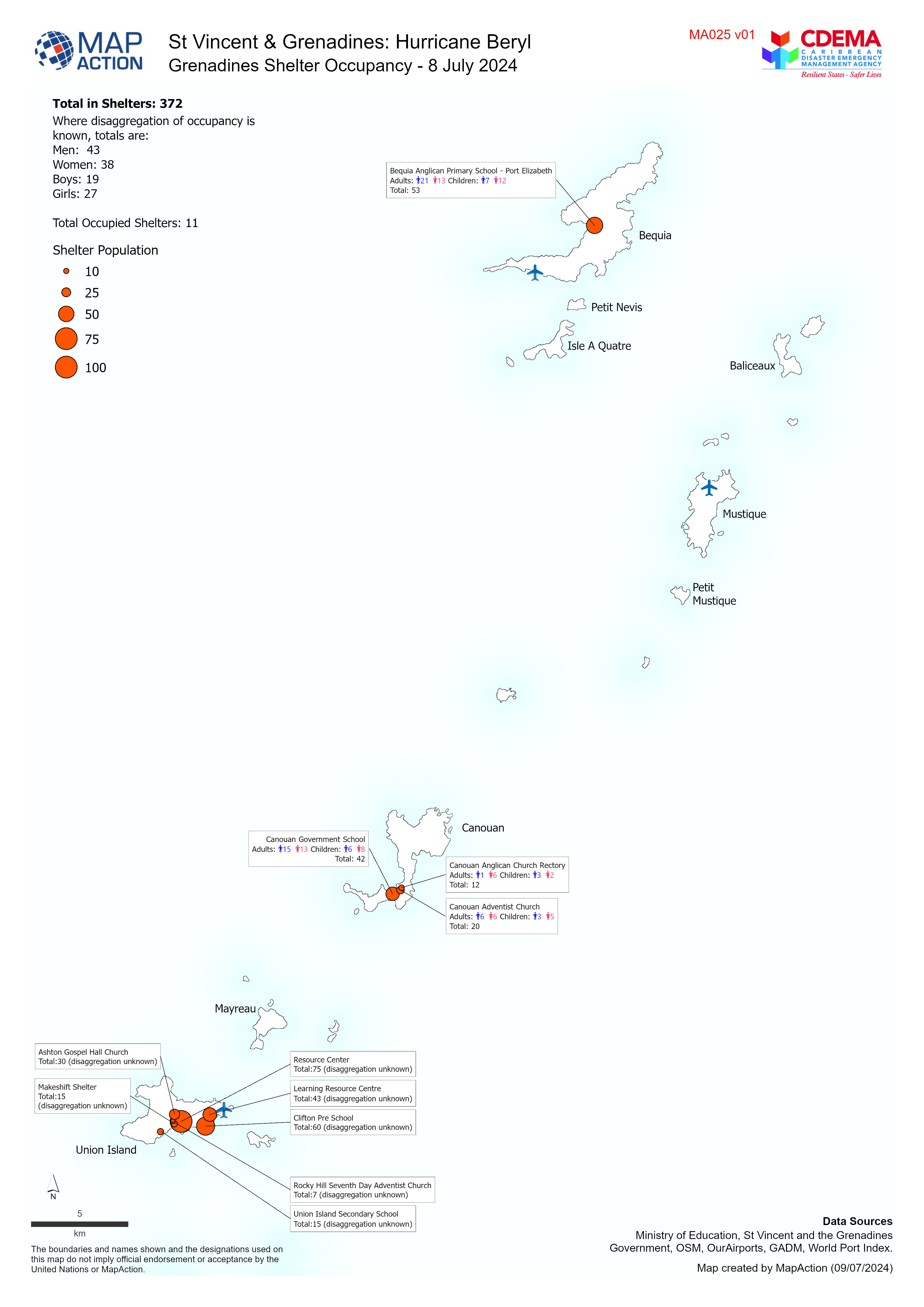
Overview map of the Grenadines showing Shelter Occupancy as of 8 July 2024.
Additional Information
| Field | Value |
|---|---|
| Data last updated | July 9, 2024 |
| Metadata last updated | July 9, 2024 |
| Created | July 9, 2024 |
| Format | JPEG |
| License | License not specified |
| Has views | True |
| Id | f25edd7f-3b62-4316-b8d3-495ce46872a2 |
| Mimetype | image/jpeg |
| On same domain | True |
| Package id | 8122c85d-a597-4b71-9890-b55f75618cf1 |
| Position | 1 |
| Revision id | 937fa330-3af9-4388-b93e-f3cfc3cd4e10 |
| Size | 948.4 KiB |
| State | active |
| Url type | upload |