MA018-v06-vct-shelter-occupancy-300dpi.jpg
From the dataset abstract
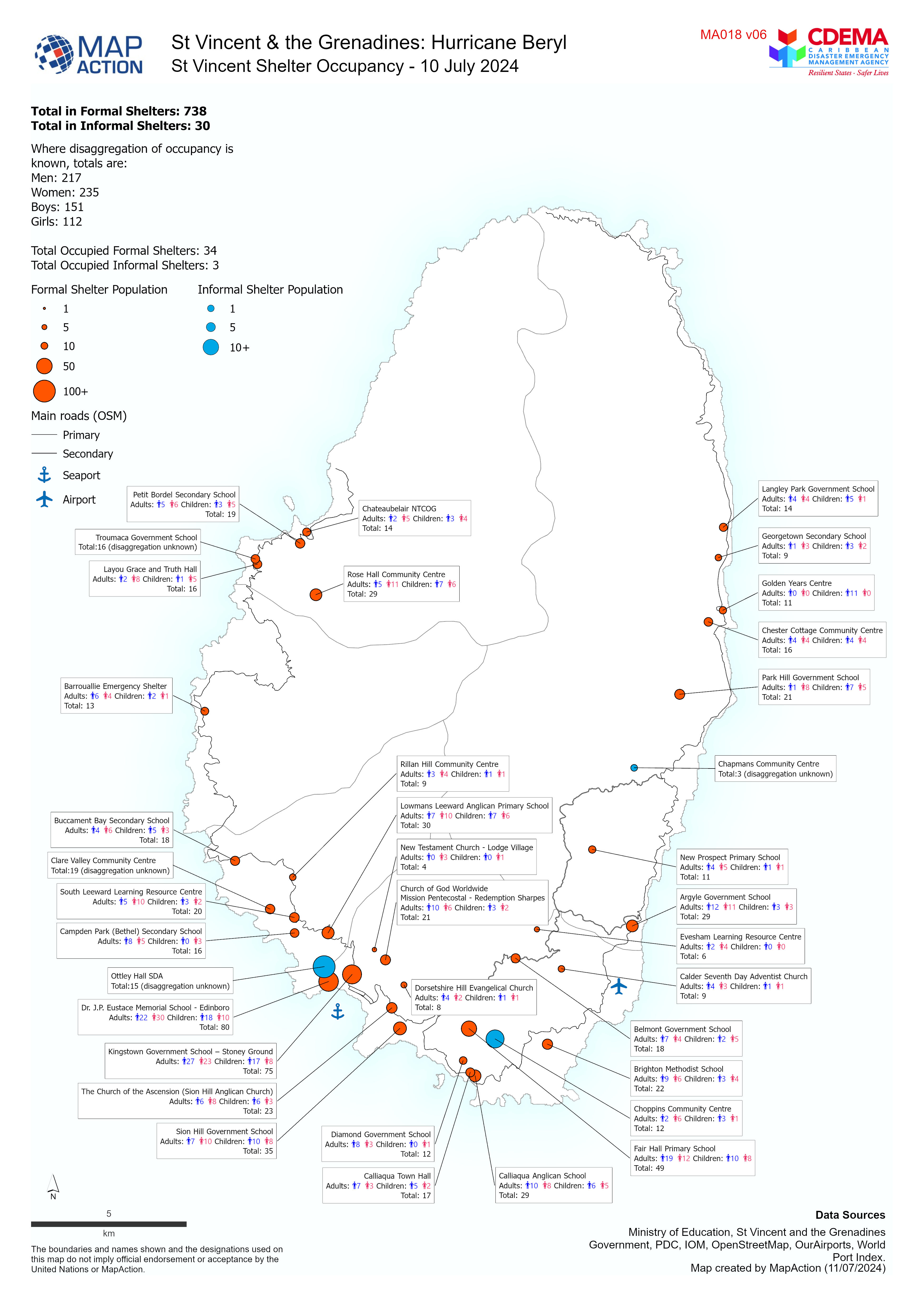
Overview map of St Vincent showing Shelter Occupancy as of 10 July 2024.
Additional Information
| Field | Value |
|---|---|
| Data last updated | July 11, 2024 |
| Metadata last updated | July 11, 2024 |
| Created | July 11, 2024 |
| Format | JPEG |
| License | License not specified |
| Has views | True |
| Id | bd14349f-3e97-4dea-b6b4-e029c6f28d08 |
| Mimetype | image/jpeg |
| On same domain | True |
| Package id | 9a46faef-e474-4de3-971d-19bcf790c8cb |
| Position | 1 |
| Revision id | 7b7d2b12-c932-4e0d-9b51-ac912e55bd32 |
| Size | 1.4 MiB |
| State | active |
| Url type | upload |