MA006-v01-vct-mayreau-imagery-300dpi.jpg
From the dataset abstract
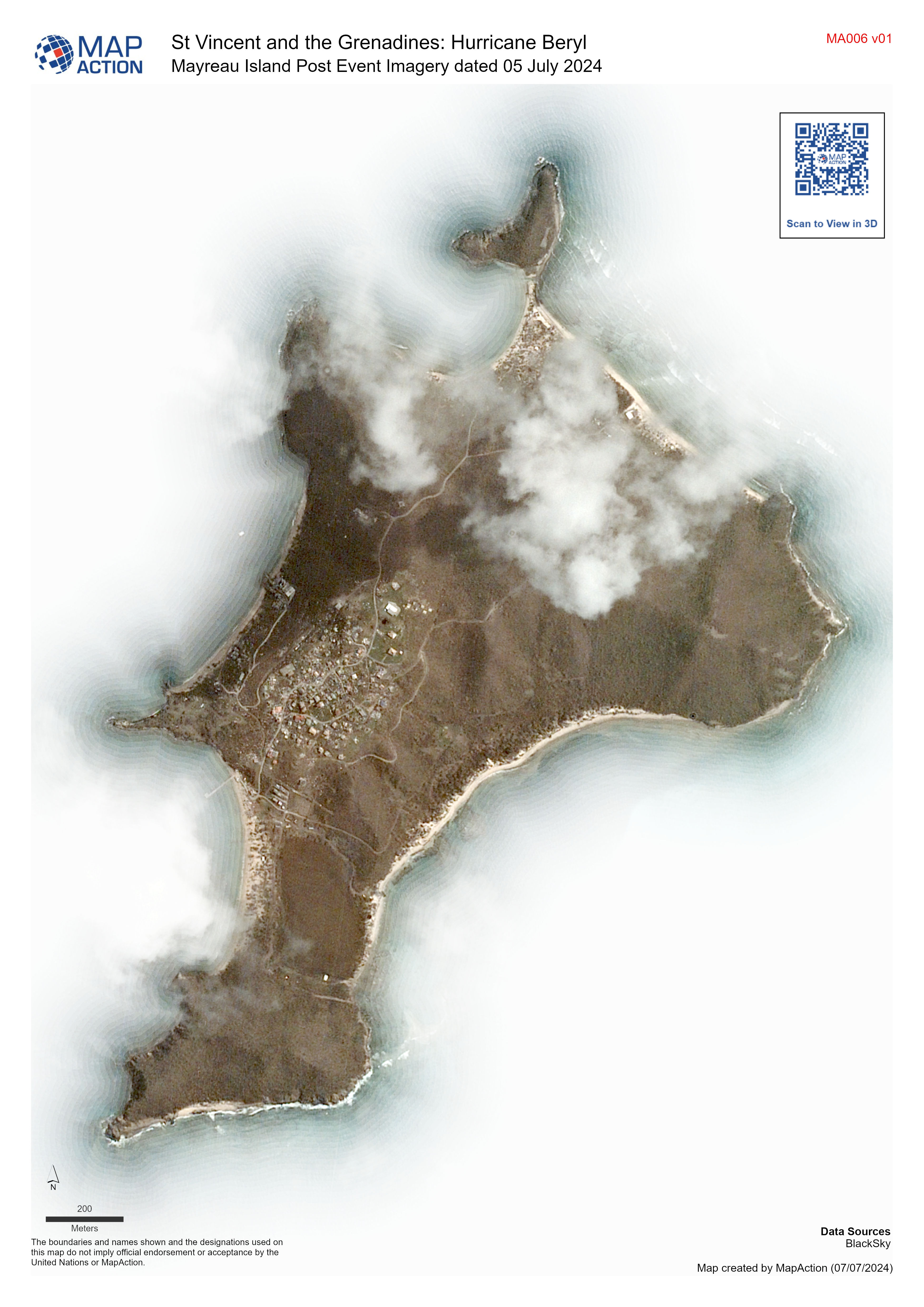
Overview map of Mayreau Island, St Vincent and the Grenadine Islands. Imagery dated 05 July 2024
Source: Mayreau Island Post Event Imagery dated 05 July 2024
Additional Information
| Field | Value |
|---|---|
| Data last updated | July 7, 2024 |
| Metadata last updated | July 7, 2024 |
| Created | July 7, 2024 |
| Format | JPEG |
| License | License not specified |
| Has views | True |
| Id | 8f24a45e-f8df-4b45-8b68-d0ec39064740 |
| Mimetype | image/jpeg |
| On same domain | True |
| Package id | a4b82d6f-238a-4f34-ab0d-7b2612e463ac |
| Position | 1 |
| Revision id | 6a5b5c62-e658-4ab8-bbe6-e55a49f037a3 |
| Size | 1.4 MiB |
| State | active |
| Url type | upload |