MA005-v01-vct-mayreau-overview-300dpi.jpg
From the dataset abstract
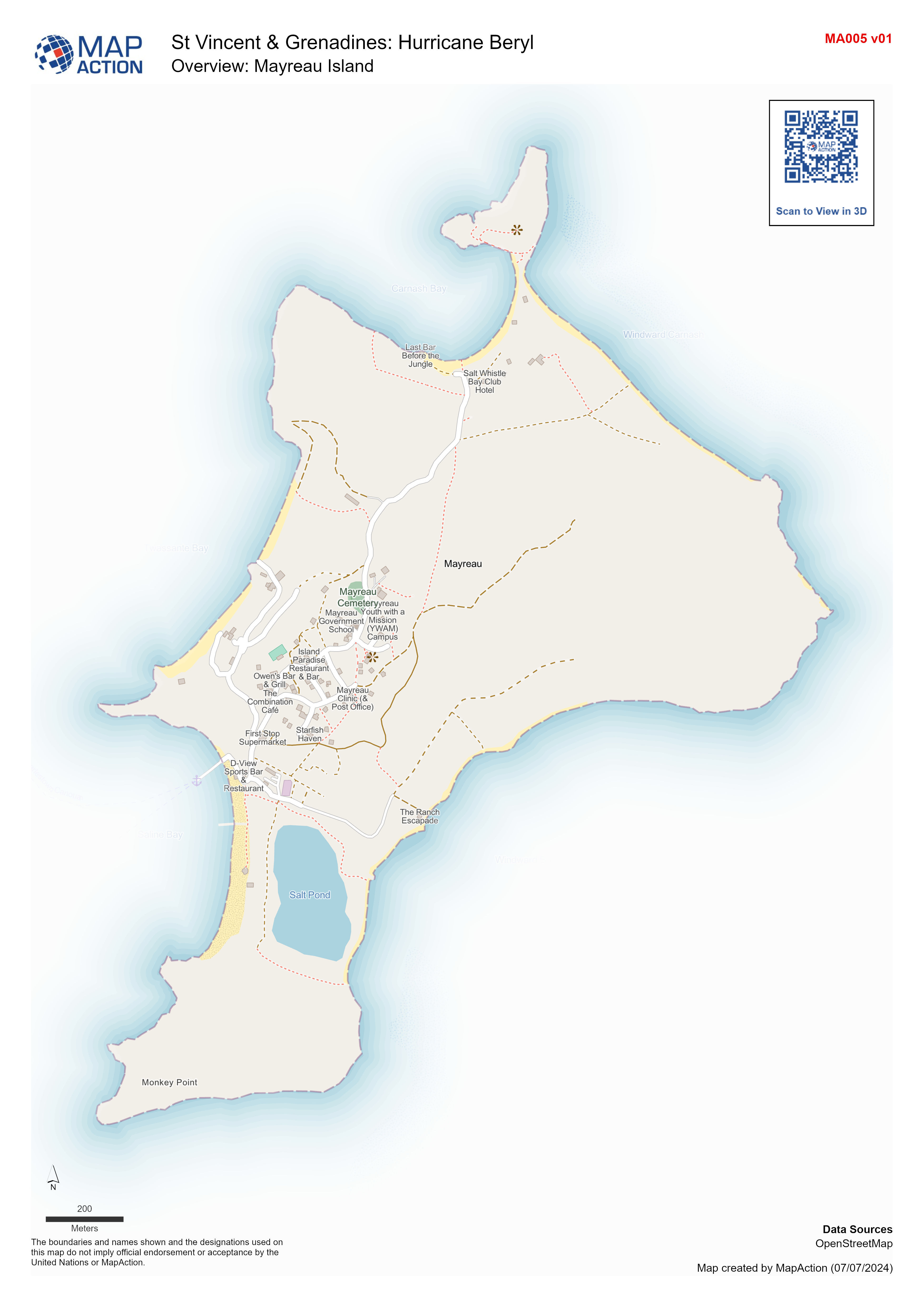
Overview map of Mayreau Island, St Vincent and the Grenadine Islands.
Source: Overview: Mayreau Island
Additional Information
| Field | Value |
|---|---|
| Data last updated | July 7, 2024 |
| Metadata last updated | July 7, 2024 |
| Created | July 7, 2024 |
| Format | JPEG |
| License | License not specified |
| Has views | True |
| Id | 38aff5eb-3ee3-4ea6-a09c-b015c3cb2486 |
| Mimetype | image/jpeg |
| On same domain | True |
| Package id | 9b4a0669-95b6-469a-94fa-8572a5dfb3cd |
| Position | 1 |
| Revision id | 7cc8926d-76b8-42a8-bdd4-47b8545c9a8a |
| Size | 915.5 KiB |
| State | active |
| Url type | upload |