thumbnail.png
From the dataset abstract
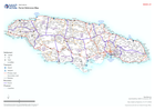
Country overview showing administrative parishes, main settlements, transport links, airports and ports.
Source: Parish Reference Map
Additional Information
| Field | Value |
|---|---|
| Data last updated | July 10, 2024 |
| Metadata last updated | July 10, 2024 |
| Created | July 10, 2024 |
| Format | PNG |
| License | Creative Commons Attribution |
| Has views | True |
| Id | 7f974d5d-0e41-4dfe-b30d-8d8697d180ba |
| Mimetype | image/png |
| On same domain | True |
| Package id | bf1c87cb-af99-4f19-af69-2bced75e868f |
| Position | 2 |
| Revision id | 75700826-3730-459b-a131-a22adcc884c1 |
| Size | 15.7 KiB |
| State | active |
| Url type | upload |