MA002-v01-jam-country-parishes-300dpi.jpg
From the dataset abstract
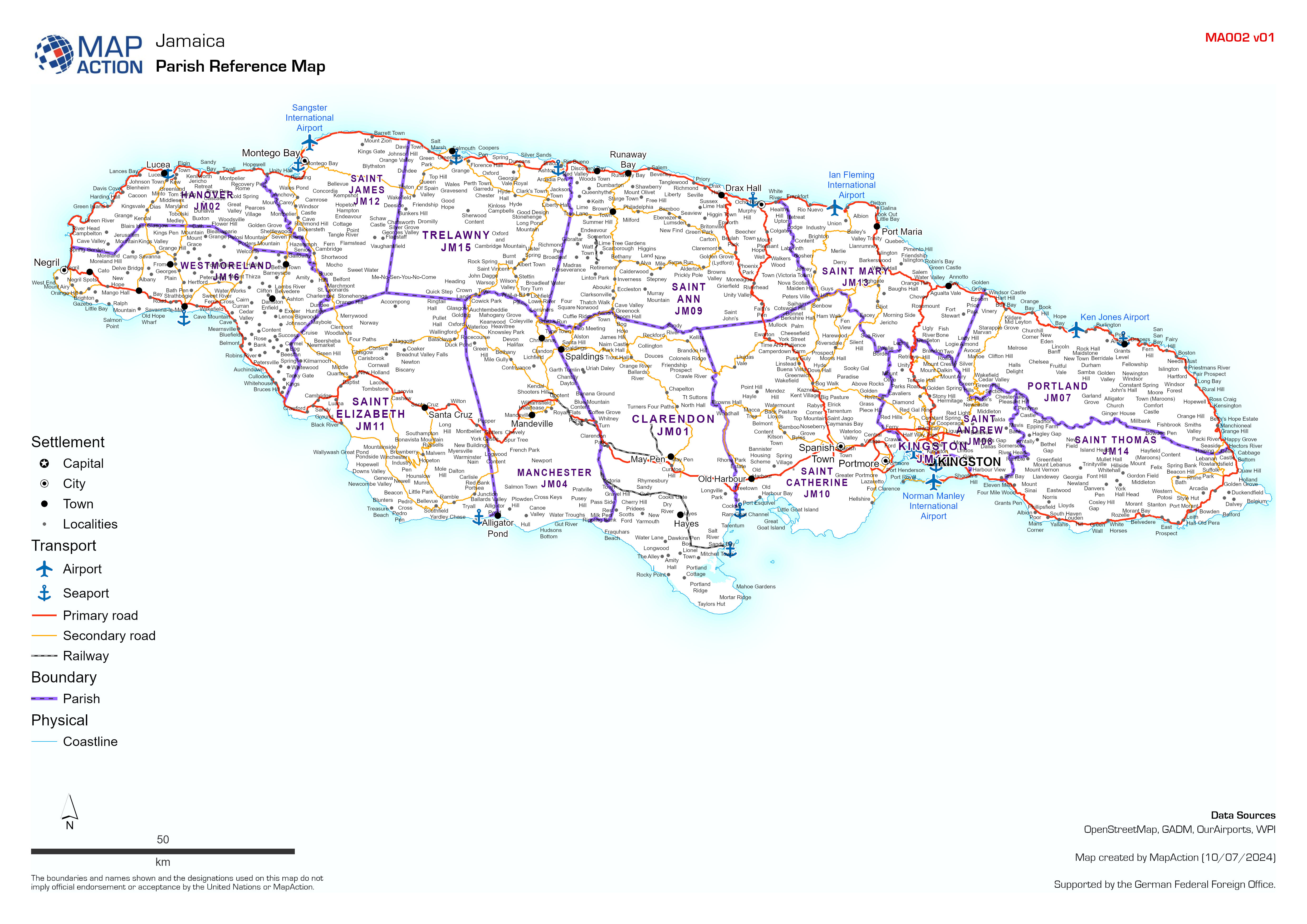
Country overview showing administrative parishes, main settlements, transport links, airports and ports.
Source: Parish Reference Map
Additional Information
| Field | Value |
|---|---|
| Data last updated | July 10, 2024 |
| Metadata last updated | July 10, 2024 |
| Created | July 10, 2024 |
| Format | JPEG |
| License | Creative Commons Attribution |
| Has views | True |
| Id | 492e0b4e-a67d-481e-bc68-6ba34f6d1daa |
| Mimetype | image/jpeg |
| On same domain | True |
| Package id | bf1c87cb-af99-4f19-af69-2bced75e868f |
| Position | 1 |
| Revision id | f67baa2e-4577-4e0a-b6db-52d0f1e68996 |
| Size | 2.1 MiB |
| State | active |
| Url type | upload |