MA018_v5 ShelterStatus_Carriacou-300dpi.jpg
From the dataset abstract
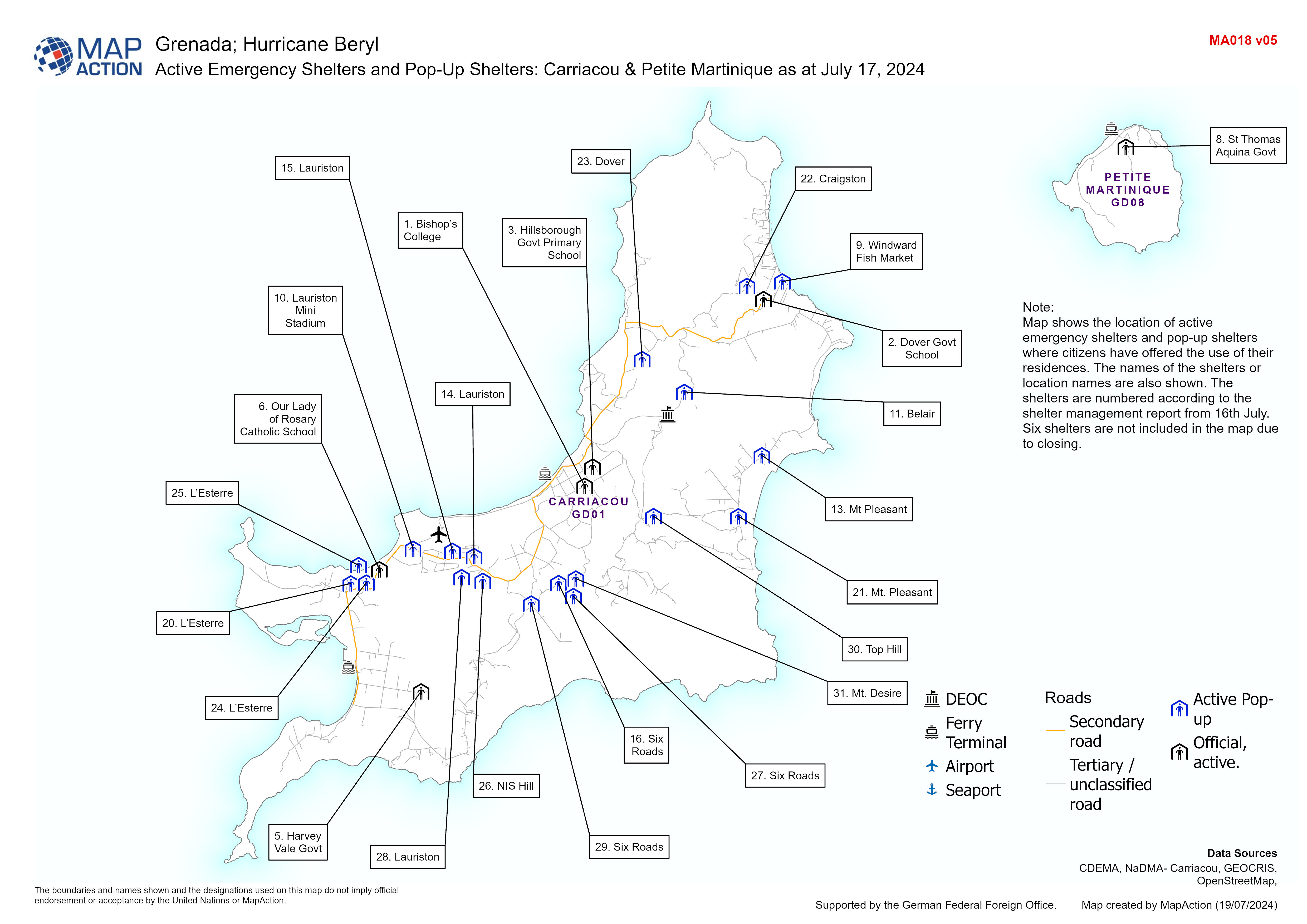
Map displaying active emergency shelters and pop-up shelters in Carriacou/Petite Martinique. The names of the shelters or location names are also shown.
Source: Active Emergency Shelters and Pop-Up Shelters: Carriacou & Petite Martinique as at July 17, 2024
Additional Information
| Field | Value |
|---|---|
| Data last updated | July 19, 2024 |
| Metadata last updated | July 19, 2024 |
| Created | July 19, 2024 |
| Format | JPEG |
| License | License not specified |
| Has views | True |
| Id | c4b4bada-1c69-4d25-8271-38dbfe966199 |
| Mimetype | image/jpeg |
| On same domain | True |
| Package id | 9ab7fb01-8f6b-47b2-b1b6-cee289b31621 |
| Position | 1 |
| Revision id | 73e7dcbb-87b3-4593-bc0e-68bd89b61e59 |
| Size | 1.2 MiB |
| State | active |
| Url type | upload |