MA018_v4 ShelterStatus_Carriacou-300dpi.jpg
From the dataset abstract
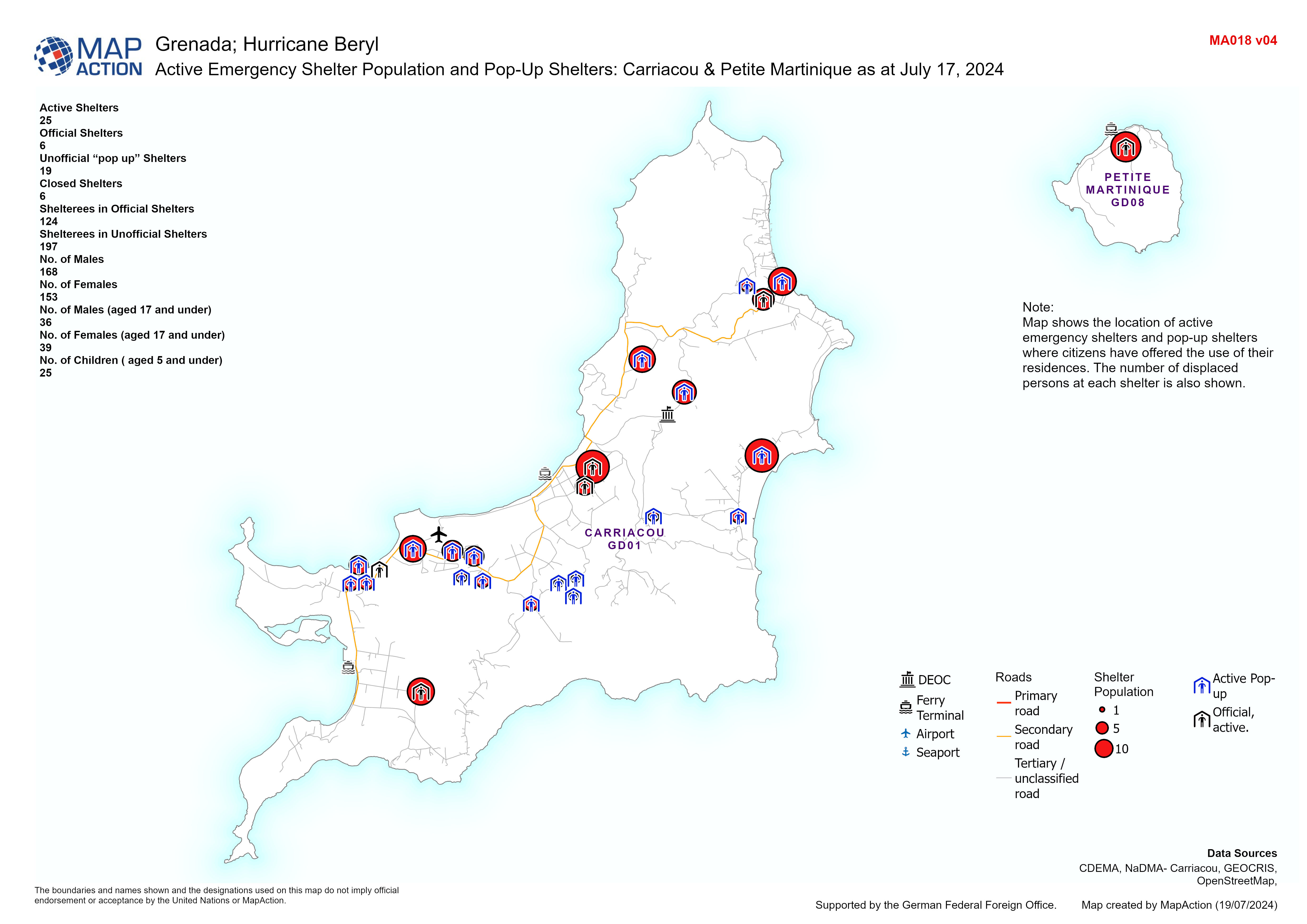
Map displaying population of active emergency shelters and pop-up shelters in Carriacou/Petite Martinique and the number of displaced persons that are in them.
Additional Information
| Field | Value |
|---|---|
| Data last updated | July 19, 2024 |
| Metadata last updated | July 19, 2024 |
| Created | July 19, 2024 |
| Format | JPEG |
| License | License not specified |
| Has views | True |
| Id | 8e3c0a2c-ea09-4b2e-b466-a8c5adbc88d4 |
| Mimetype | image/jpeg |
| On same domain | True |
| Package id | 0efbd01e-2217-4338-aa5e-6153a88144ae |
| Position | 1 |
| Revision id | 5b2167b3-d2a2-4cb7-8454-e3de0c23c1b1 |
| Size | 1 MiB |
| State | active |
| Url type | upload |