MA018_v3 ShelterStatus_Carriacou-300dpi.jpg
From the dataset abstract
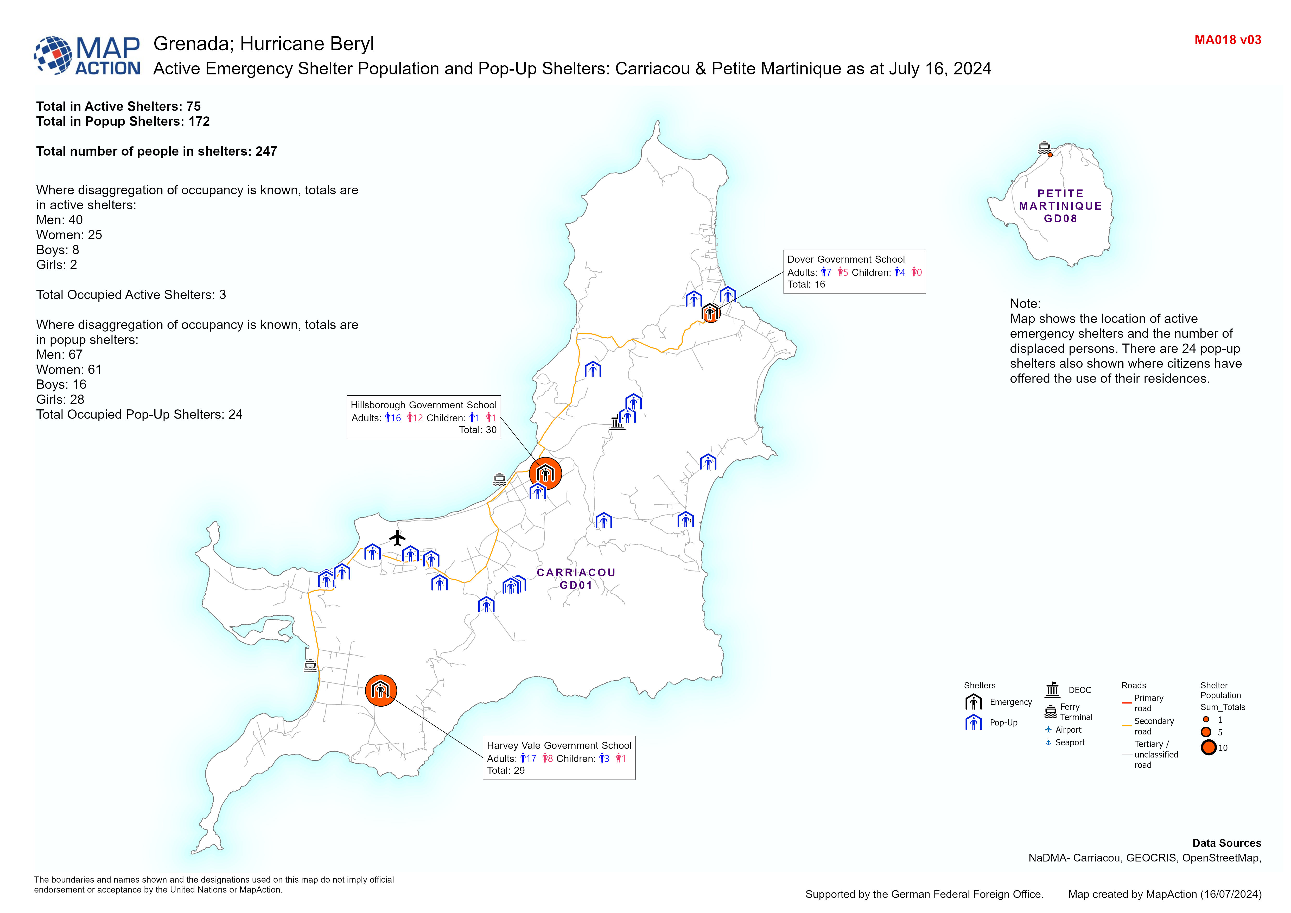
Map displaying population of active emergency shelters and pop-up shelters in Carriacou and the number of displaced persons that are in them.
Additional Information
| Field | Value |
|---|---|
| Data last updated | July 17, 2024 |
| Metadata last updated | July 17, 2024 |
| Created | July 17, 2024 |
| Format | JPEG |
| License | License not specified |
| Has views | True |
| Id | d6ac3692-459e-4e65-b96b-0f7485ec6140 |
| Mimetype | image/jpeg |
| On same domain | True |
| Package id | 40b5db90-fe3e-4e16-b103-64977730dba7 |
| Position | 1 |
| Revision id | a37fb5e3-2387-4e4f-a638-7c9134673537 |
| Size | 1.1 MiB |
| State | active |
| Url type | upload |