MA014-v01-grd-infrastructure_carriacou-300dpi.jpg
From the dataset abstract
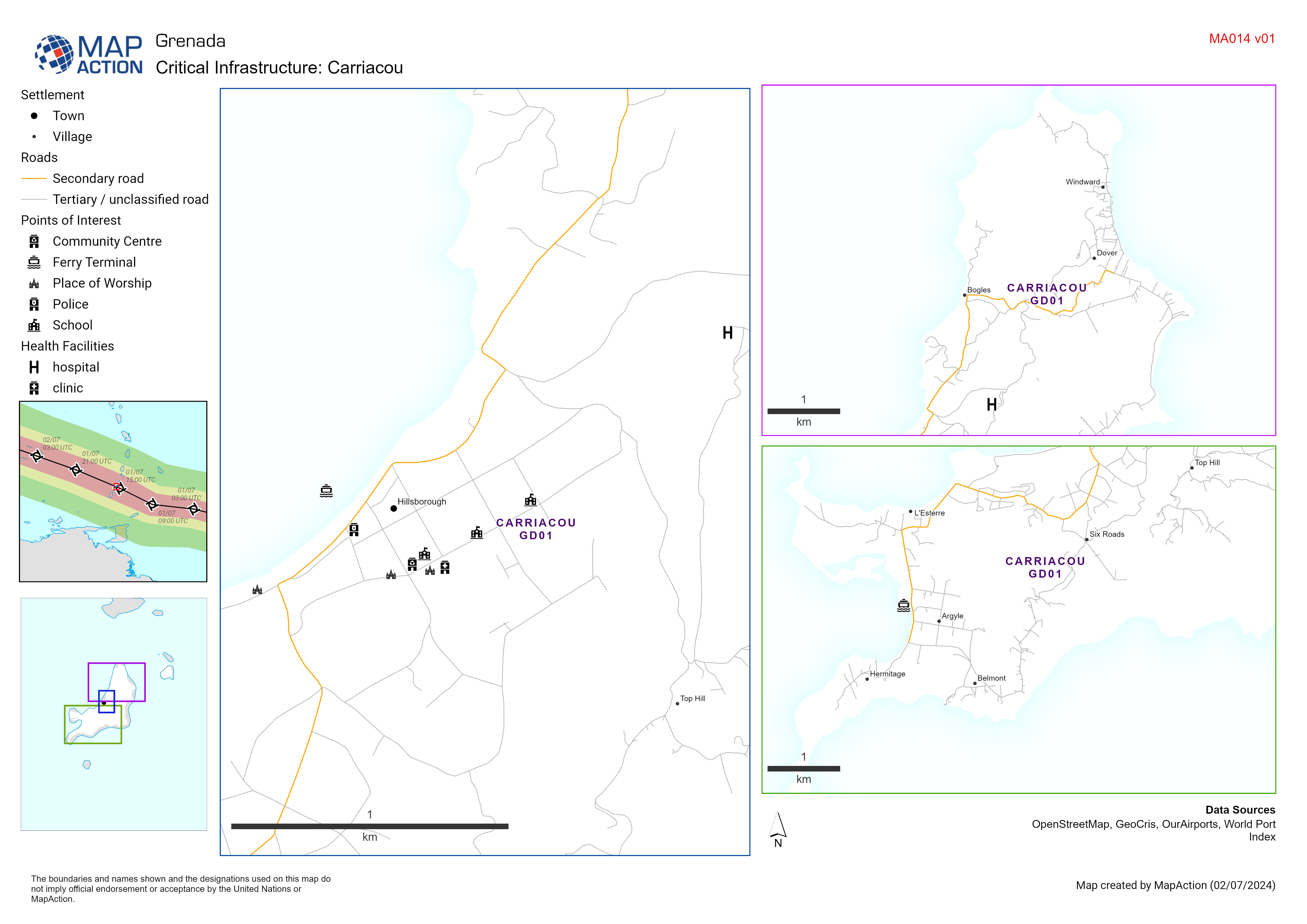
Map displaying key infrastructure in Carriacou Grenada (including schools, health facilities and emergency services) potentially impacted by Hurricane Beryl.
Additional Information
| Field | Value |
|---|---|
| Data last updated | July 3, 2024 |
| Metadata last updated | July 3, 2024 |
| Created | July 3, 2024 |
| Format | JPEG |
| License | Creative Commons Attribution |
| Has views | True |
| Id | 261c22ae-b93d-41ed-890a-9c9be49bc246 |
| Mimetype | image/jpeg |
| On same domain | True |
| Package id | f244c1c4-6ef8-49e9-ba5c-5d95e772d6ed |
| Revision id | f58f92cc-d04c-4894-9a1f-d201f61ffcf1 |
| Size | 1 MiB |
| State | active |
| Url type | upload |