thumbnail.png
From the dataset abstract
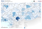
This map shows the region extent of the earthquake that happened in Turkey on the 6th of February. The map displays the District/Admin 2 Estimated Total Population.
Source: Estimate Population per District
Additional Information
| Field | Value |
|---|---|
| Data last updated | February 9, 2023 |
| Metadata last updated | February 9, 2023 |
| Created | February 9, 2023 |
| Format | PNG |
| License | Open Data Commons Attribution License |
| Has views | True |
| Id | 204b40bd-c7ef-44dc-b837-99bb2d631fda |
| Mimetype | image/png |
| On same domain | True |
| Package id | bae10adf-02b2-49a9-adb7-b80ea96ae7a8 |
| Position | 2 |
| Revision id | 0874b059-0c7c-441d-8fd1-989f774de19c |
| Size | 25.4 KiB |
| State | active |
| Url type | upload |