MA011_v01_Baseline_Population_Districts-300dpi.jpg
From the dataset abstract
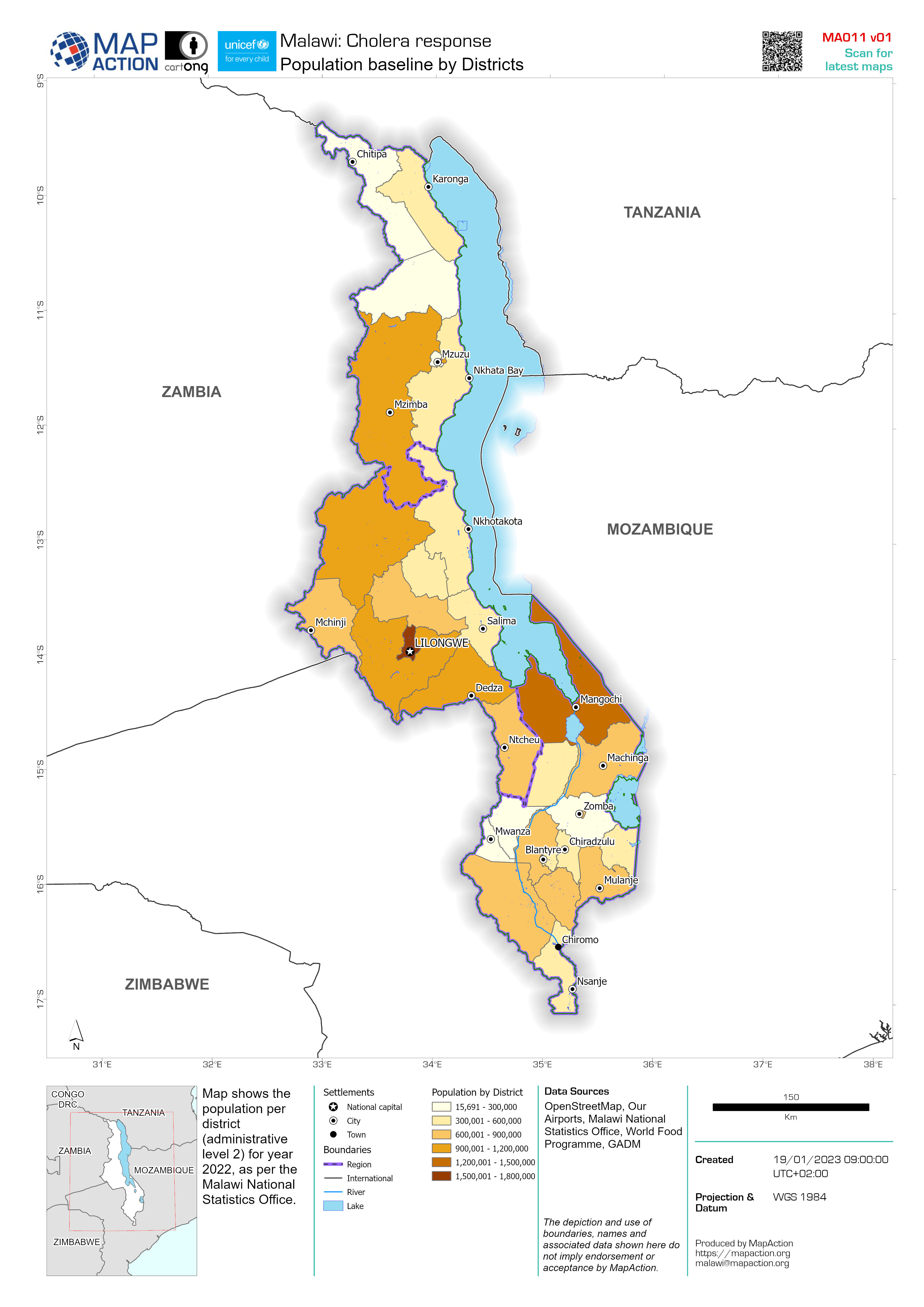
Map shows the population per district (administrative level 2) for year 2022, as per the Malawi National Statistics Office.
Source: Population baseline by Districts
Additional Information
| Field | Value |
|---|---|
| Data last updated | January 19, 2023 |
| Metadata last updated | January 19, 2023 |
| Created | January 19, 2023 |
| Format | JPEG |
| License | License not specified |
| Has views | True |
| Id | ec903f42-cfe6-4b84-9bce-5e93717a27f4 |
| Mimetype | image/jpeg |
| On same domain | True |
| Package id | 2525510c-6ce9-407a-a6c3-35d2ae063f8c |
| Revision id | 2f142c6a-6749-4819-a251-564a9223ff6e |
| Size | 1.2 MiB |
| State | active |
| Url type | upload |