MA015-v01-mdg-storm_track_baseline_population-3 ...
From the dataset abstract
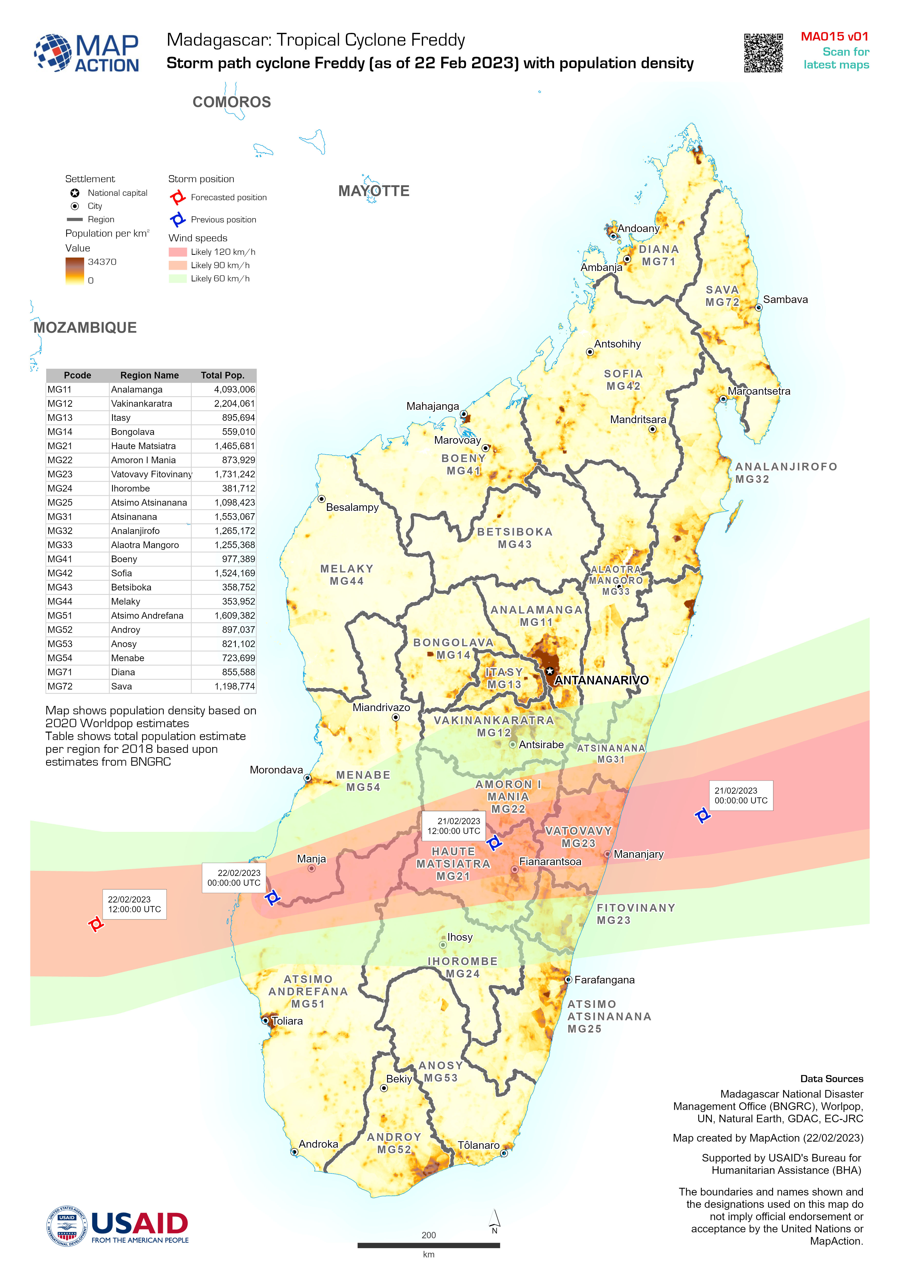
Map shows population density based on 2020 Worldpop estimates Table shows total population estimate per region for 2018 based upon estimates from BNGRC
Source: Storm path cyclone Freddy (as of 22 Feb 2023) with population density
Additional Information
| Field | Value |
|---|---|
| Data last updated | February 22, 2023 |
| Metadata last updated | February 22, 2023 |
| Created | February 22, 2023 |
| Format | JPEG |
| License | License not specified |
| Has views | True |
| Id | 61b1f8fe-aa49-4ae3-b193-29c5ffb25461 |
| Mimetype | image/jpeg |
| On same domain | True |
| Package id | 9b57f8dd-3f7d-4e18-82e3-e3dc78abc744 |
| Position | 1 |
| Revision id | f3e3f050-da68-404f-8faa-0e2226f49f2c |
| Size | 1.7 MiB |
| State | active |
| Url type | upload |