MA014v02-affected-population-0802-300dpi.jpeg
From the dataset abstract
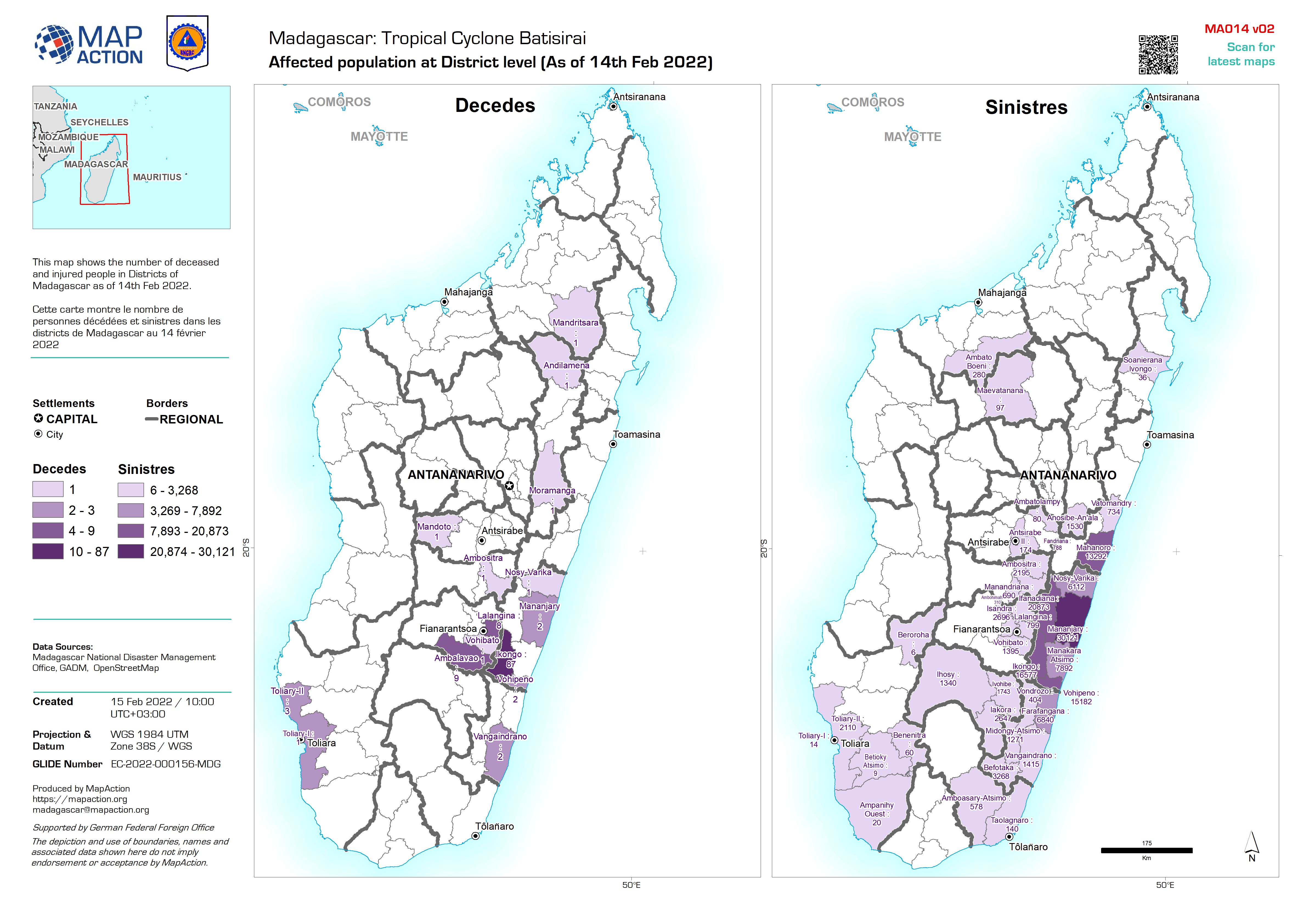
This map shows the number of deceased and injured people in Districts of Madagascar as of 14th Feb 2022. Cette carte montre le nombre de personnes décédées et sinistres dans les...
Source: Affected population at District level (As of 14th Feb 2022)
Additional Information
| Field | Value |
|---|---|
| Data last updated | February 15, 2022 |
| Metadata last updated | February 15, 2022 |
| Created | February 15, 2022 |
| Format | JPEG |
| License | License not specified |
| Has views | True |
| Id | 5bac2aa0-55cc-4c92-a199-7cf94616b5df |
| Mimetype | image/jpeg |
| On same domain | True |
| Package id | f60dc55d-d3d7-45f1-969f-ca7db7115bfc |
| Revision id | d5536cb1-9c13-4936-9620-6aa27d76b1c1 |
| Size | 1.3 MiB |
| State | active |
| Url type | upload |