MA014v01-affected-population-0802-300dpi.jpeg
From the dataset abstract
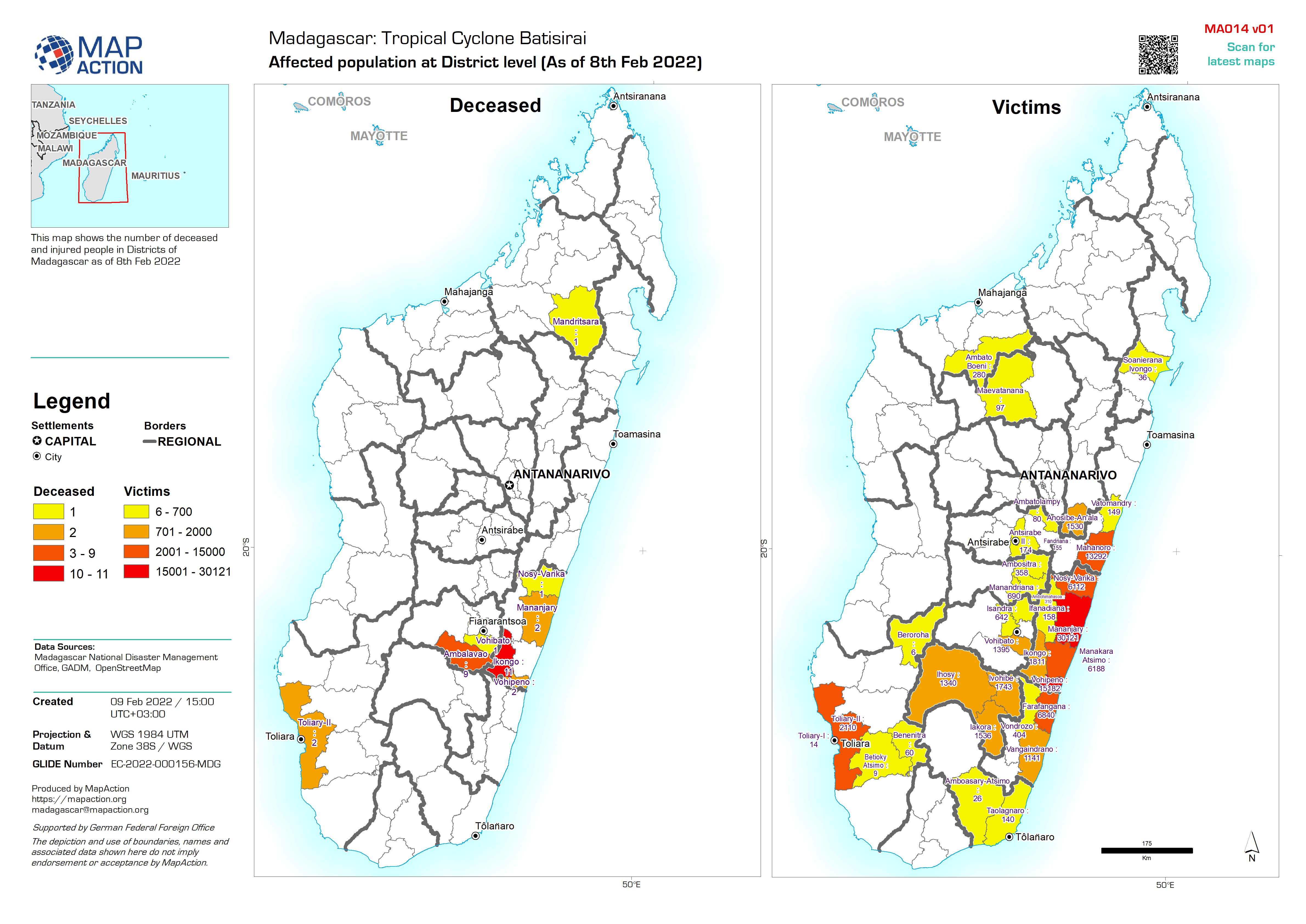
This map shows the number of deceased and injured people in Districts of Madagascar as of 8th Feb 2022
Source: Affected population at District level (As of 8th Feb 2022)
Additional Information
| Field | Value |
|---|---|
| Data last updated | February 9, 2022 |
| Metadata last updated | February 9, 2022 |
| Created | February 9, 2022 |
| Format | JPEG |
| License | Other (Open) |
| Has views | True |
| Id | 0441c482-489d-49d3-aea9-c5cc9d2eecd1 |
| Mimetype | image/jpeg |
| On same domain | True |
| Package id | 3b33db4f-91b6-4dc4-bb99-5bcd5d937980 |
| Revision id | e94f4620-b78a-4cee-a145-2fd6ba84c57c |
| Size | 1.3 MiB |
| State | active |
| Url type | upload |