MA023-v01-vct-protected_areas-300dpi.jpeg
From the dataset abstract
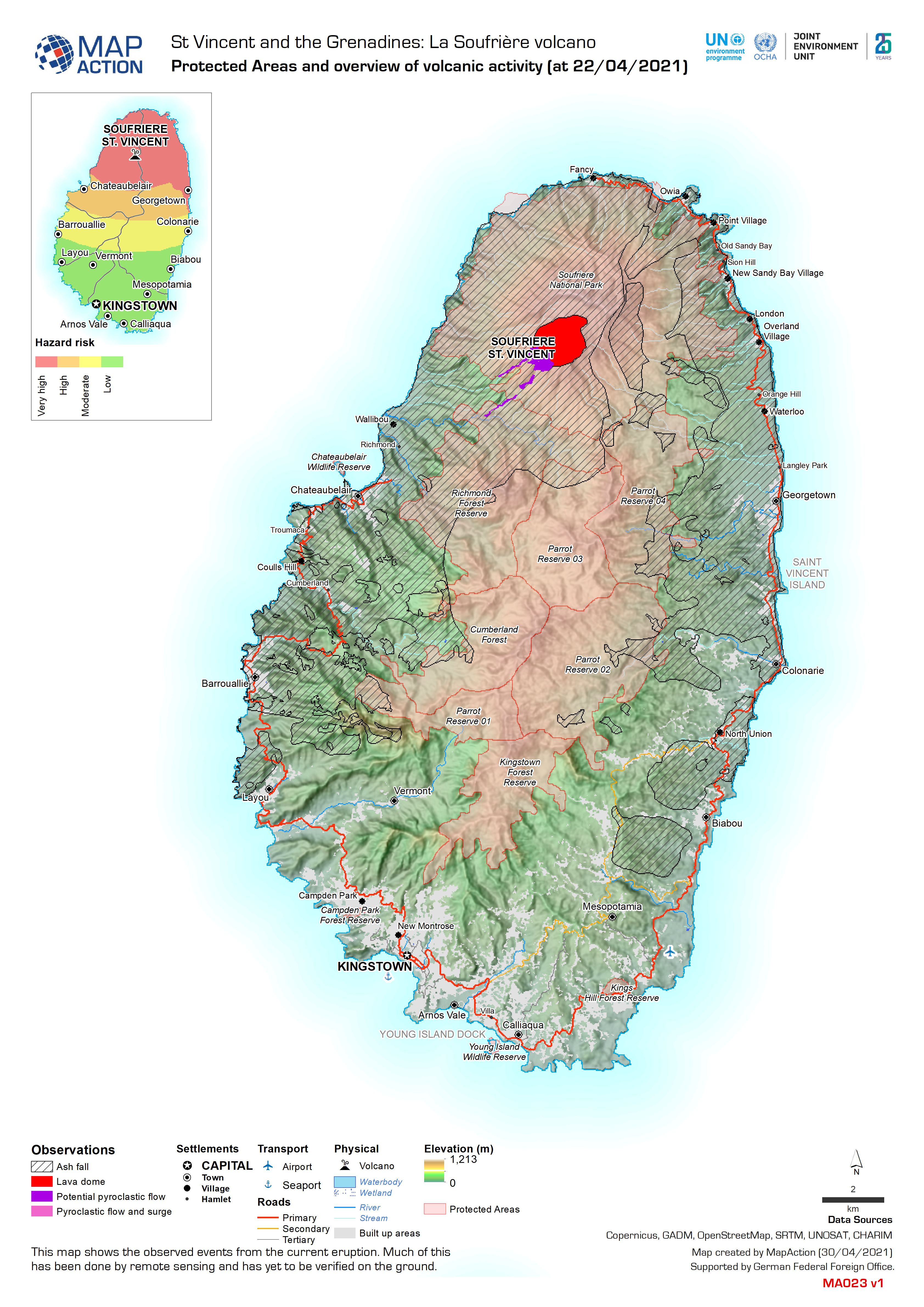
This map shows the observed events from the current eruption. Much of this has been done by remote sensing and has yet to be verified on the ground.
Source: Protected Areas and overview of volcanic activity (at 22/04/2021)
Additional Information
| Field | Value |
|---|---|
| Data last updated | May 1, 2021 |
| Metadata last updated | May 1, 2021 |
| Created | May 1, 2021 |
| Format | JPEG |
| License | License not specified |
| Has views | True |
| Id | 8325402a-2a45-4a46-9a02-0217cee4eb3c |
| Mimetype | image/jpeg |
| On same domain | True |
| Package id | c990f18a-83f6-434a-b20b-ec231596233a |
| Revision id | 69256108-534d-49cb-93ba-e1e4c0f653c7 |
| Size | 1.7 MiB |
| State | active |
| Url type | upload |