MA006-v02-vct-population-displaced-300dpi.jpeg
From the dataset abstract
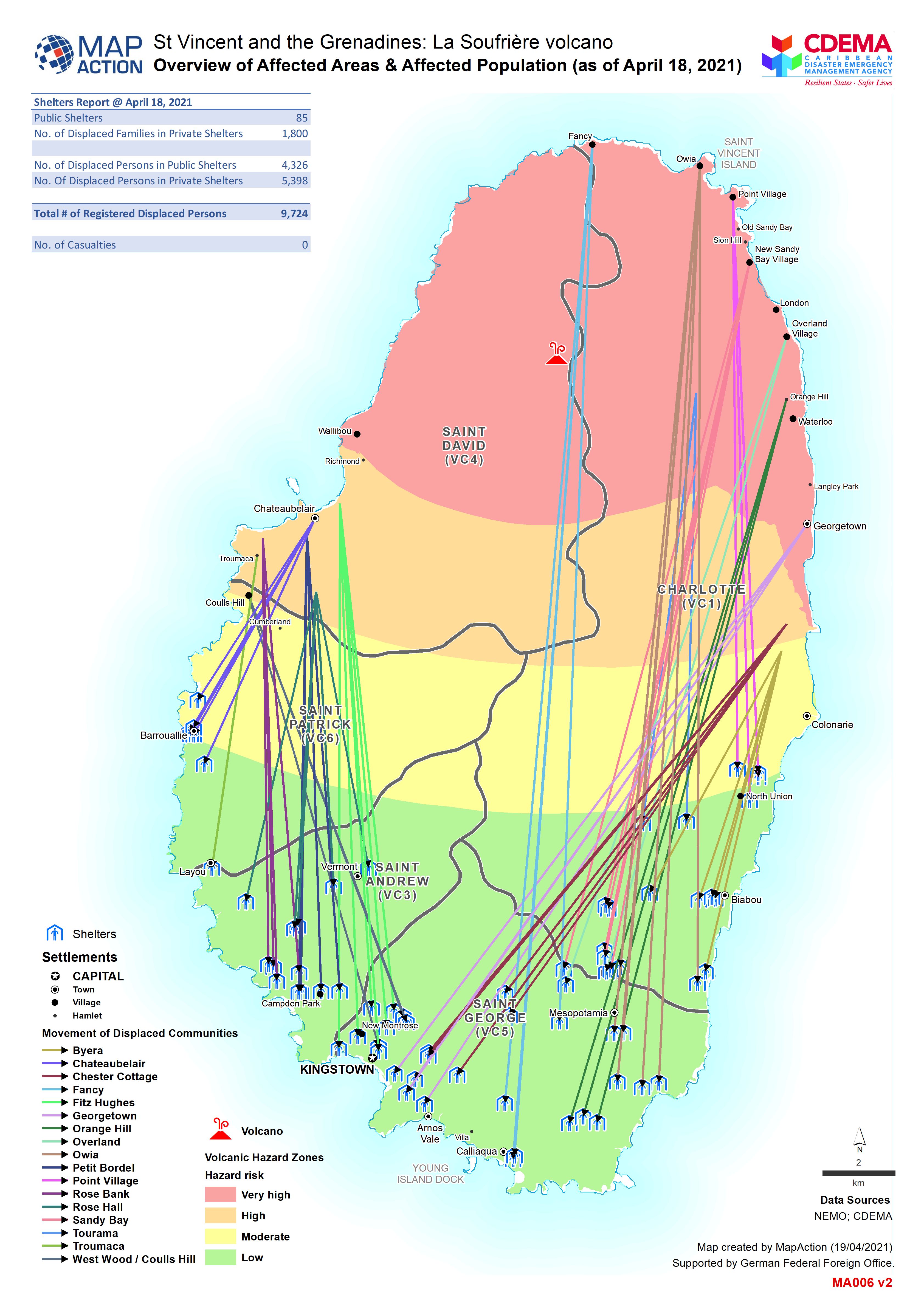
Map shows movement of displaced persons from affected communities.
Source: Overview of Affected Areas & Affected Population (as of 18 Apr 2021)
Additional Information
| Field | Value |
|---|---|
| Data last updated | April 20, 2021 |
| Metadata last updated | April 20, 2021 |
| Created | April 20, 2021 |
| Format | JPEG |
| License | License not specified |
| Has views | True |
| Id | f6ec269f-a246-47ec-bfd6-82059feef5c5 |
| Mimetype | image/jpeg |
| On same domain | True |
| Package id | 5f52cb99-564a-4a3f-97cc-6ed20bdea95f |
| Revision id | 278eae32-a164-4fcf-af5b-3a3ea3999f52 |
| Size | 1.3 MiB |
| State | active |
| Url type | upload |
