ma012_ken_ahn_assm_agri_a3_v01.jpg
From the dataset abstract
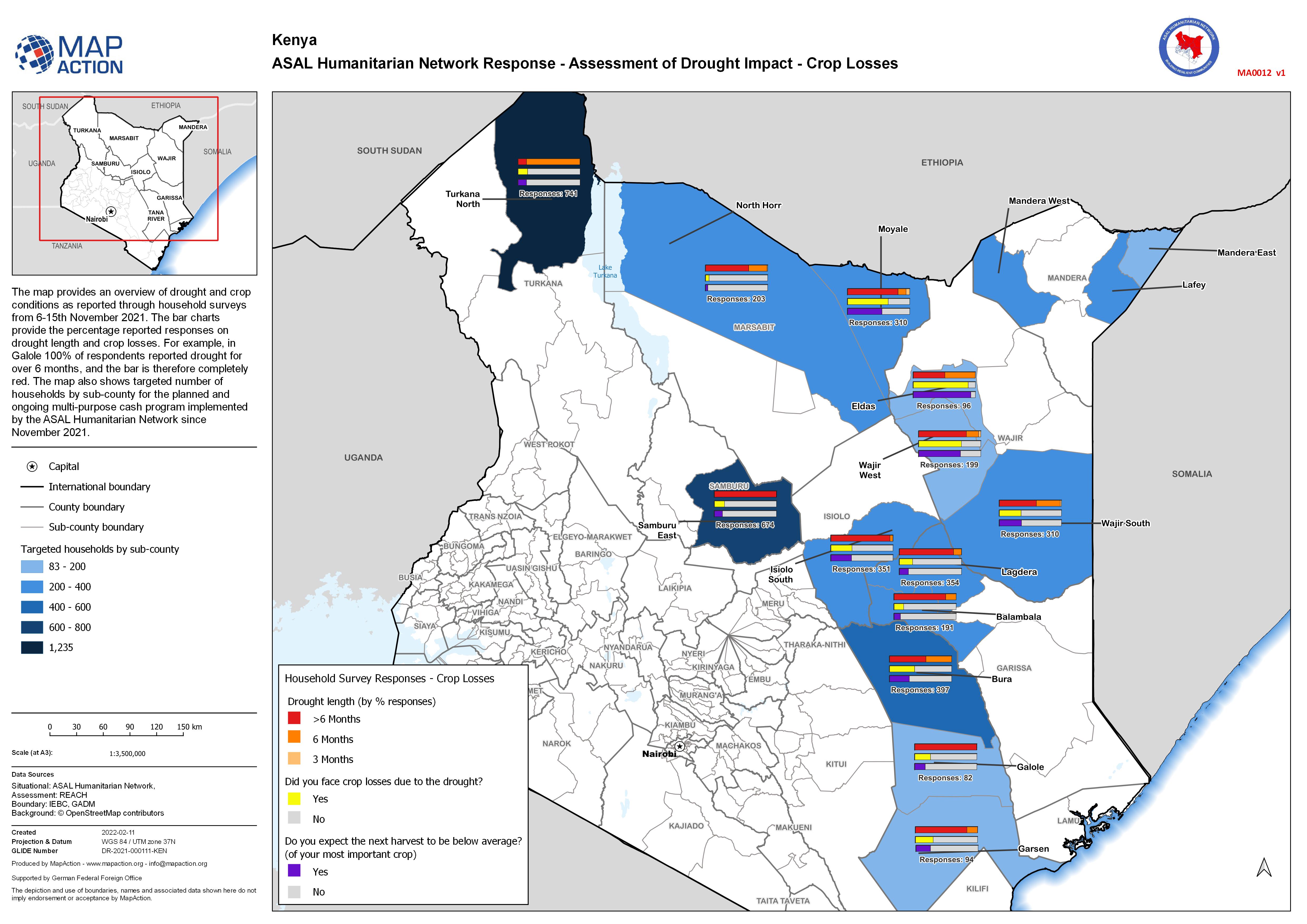
The map provides an overview of drought and crop conditions as reported through household surveys from 6-15th November 2021. The bar charts provide the percentage reported responses on...
Source: ASAL Humanitarian Network Response - Assessment of Drought Impact - Crop Losses
Additional Information
| Field | Value |
|---|---|
| Data last updated | February 19, 2022 |
| Metadata last updated | February 19, 2022 |
| Created | February 19, 2022 |
| Format | JPEG |
| License | License not specified |
| Has views | True |
| Id | 93769c38-90f3-4944-842b-51f773161edd |
| Mimetype | image/jpeg |
| On same domain | True |
| Package id | d4d628af-eba5-4d02-b44a-77b889a9a196 |
| Position | 1 |
| Revision id | 7153a4d5-5515-42aa-9af5-87d539b1603b |
| Size | 1.2 MiB |
| State | active |
| Url type | upload |