MA036_v01_Aid_Distribution_Food_Sector-300dpi.jpeg
From the dataset abstract
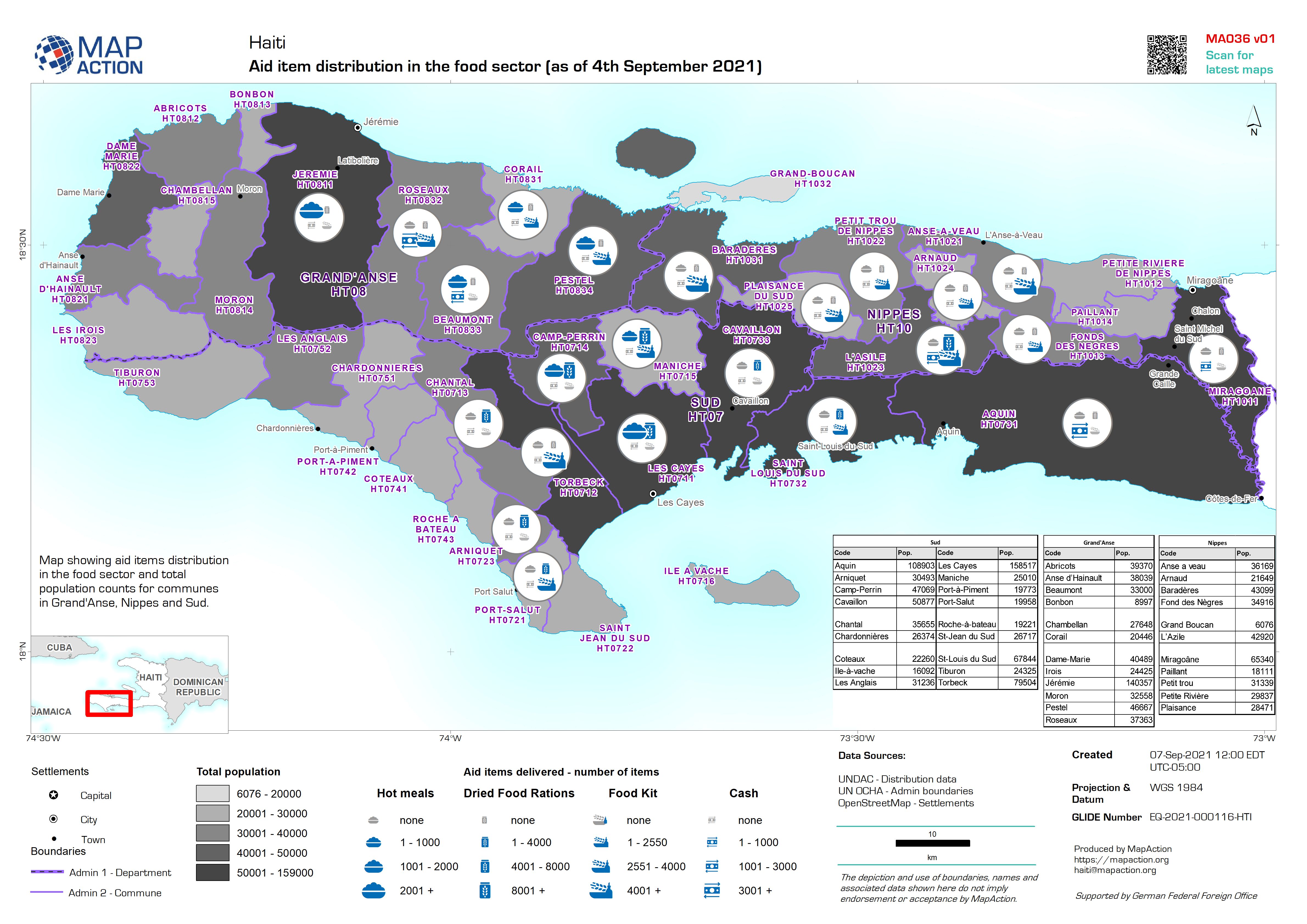
Map showing aid items distribution in the food sector and total population counts for communes in Grand'Anse, Nippes and Sud.
Source: Aid item distribution in the food sector (as of 4th September 2021)
Additional Information
| Field | Value |
|---|---|
| Data last updated | September 8, 2021 |
| Metadata last updated | September 8, 2021 |
| Created | September 8, 2021 |
| Format | JPEG |
| License | License not specified |
| Has views | True |
| Id | ea05022c-cce1-4ea3-aa8b-4de19e57c6cb |
| Mimetype | image/jpeg |
| On same domain | True |
| Package id | fb84242f-d74b-4f36-ae53-0232a8e7d8da |
| Revision id | 31b84375-12a6-463d-94c9-0e6579cb90d4 |
| Size | 1.4 MiB |
| State | active |
| Url type | upload |