thumbnail.png
From the dataset abstract
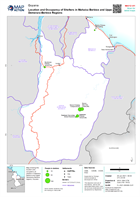
Map showing the location and occupancy of shelters in Mahaica Berbice and Upper Demerara-Berbice regions, Guyana
Source: Location and Occupancy of Shelters in Mahaica Berbice and Upper Demerara-Berbice Regions
Additional Information
| Field | Value |
|---|---|
| Data last updated | June 26, 2021 |
| Metadata last updated | June 26, 2021 |
| Created | June 26, 2021 |
| Format | PNG |
| License | License not specified |
| Has views | True |
| Id | 586e4470-1e17-4db9-bad7-2802c5cad104 |
| Mimetype | image/png |
| On same domain | True |
| Package id | 98074dc0-e3d8-4c6d-ae0c-aab1d1d090f9 |
| Position | 2 |
| Revision id | 372d47e8-c74d-4ca4-8ee0-f88c05ea7387 |
| Size | 22.2 KiB |
| State | active |
| Url type | upload |