MA011-Guatemala-Admin2-Population-IPC202010-Flo ...
From the dataset abstract
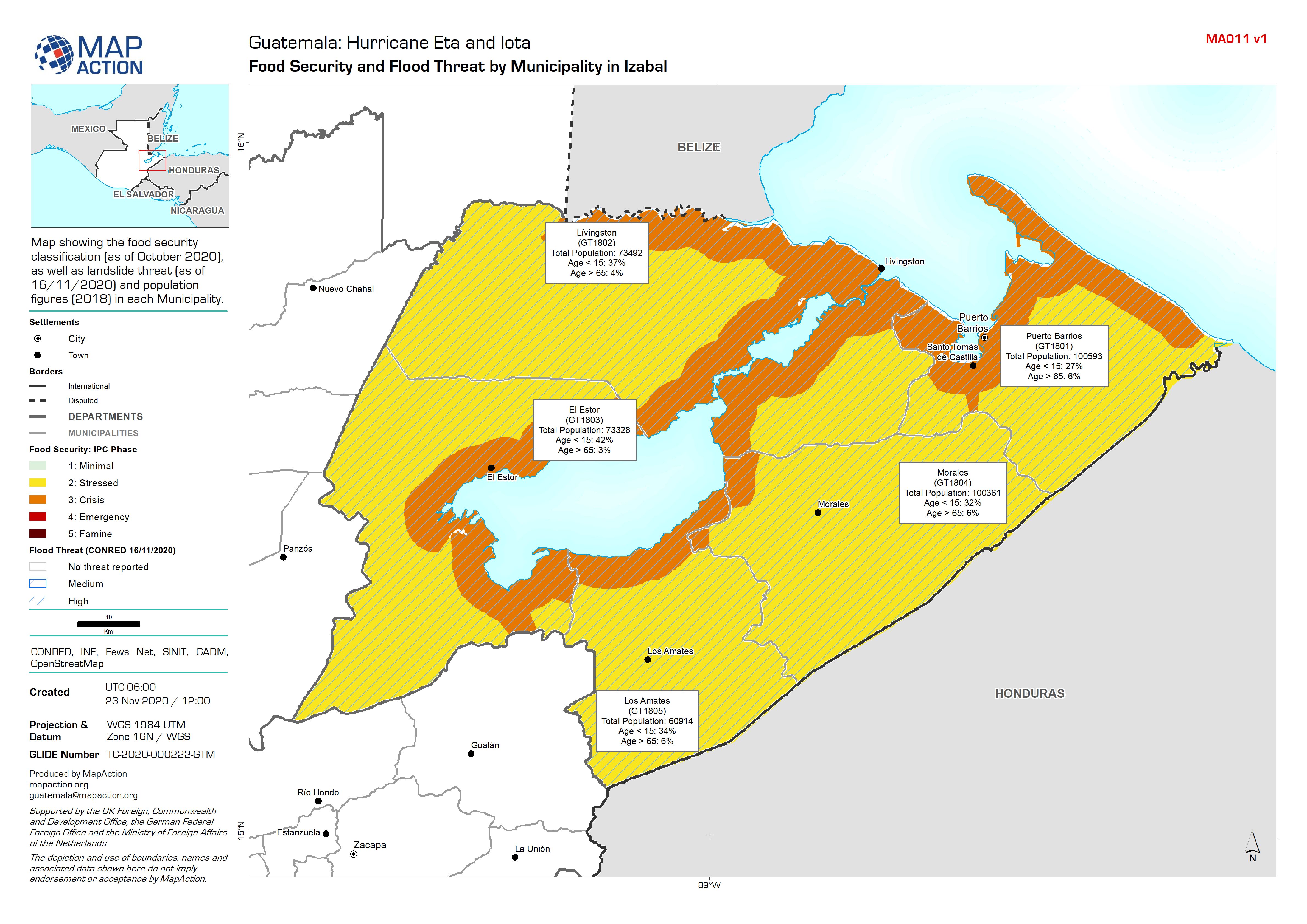
Map showing the food security classification (as of October 2020), as well as landslide threat (as of 16/11/2020) and population figures (2018) in each Municipality.
Source: Guatemala: Food Security and Flood Threat by Municipality in Izabal
Additional Information
| Field | Value |
|---|---|
| Data last updated | November 27, 2020 |
| Metadata last updated | November 27, 2020 |
| Created | November 27, 2020 |
| Format | JPEG |
| License | License not specified |
| Has views | True |
| Id | 284ce82c-dc68-48bb-a0c5-e32cc4988965 |
| Mimetype | image/jpeg |
| On same domain | True |
| Package id | 8fa11dd1-3219-414c-84c6-c34633a9fe73 |
| Revision id | ebecc3a5-1b66-4940-b079-74722a419daa |
| Size | 1.5 MiB |
| State | active |
| Url type | upload |