thumbnail.png
From the dataset abstract
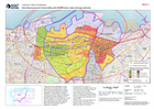
The socio-economic status of households living pre-blast in each zone was estimated by UN-Habitat based on (1) a national ranking of 498 disadvantaged area undertaken to inform the...
Source: Zone Socio-economic Vulnerability with ACAPS blast radius damage estimate
Additional Information
| Field | Value |
|---|---|
| Data last updated | August 21, 2020 |
| Metadata last updated | August 21, 2020 |
| Created | August 21, 2020 |
| Format | PNG |
| License | License not specified |
| Has views | True |
| Id | ae69af6e-7277-446c-9cec-83f8b481370b |
| Mimetype | image/png |
| On same domain | True |
| Package id | 2f68a6cd-2322-4448-b328-196ab4b657a9 |
| Position | 2 |
| Revision id | 6ca71c24-2e7d-49ce-a729-ba8de7009e5f |
| Size | 31.9 KiB |
| State | active |
| Url type | upload |