MA708_OCHA_CA_Iota_Affd_Pop_Admin2-300dpi.jpeg
From the dataset abstract
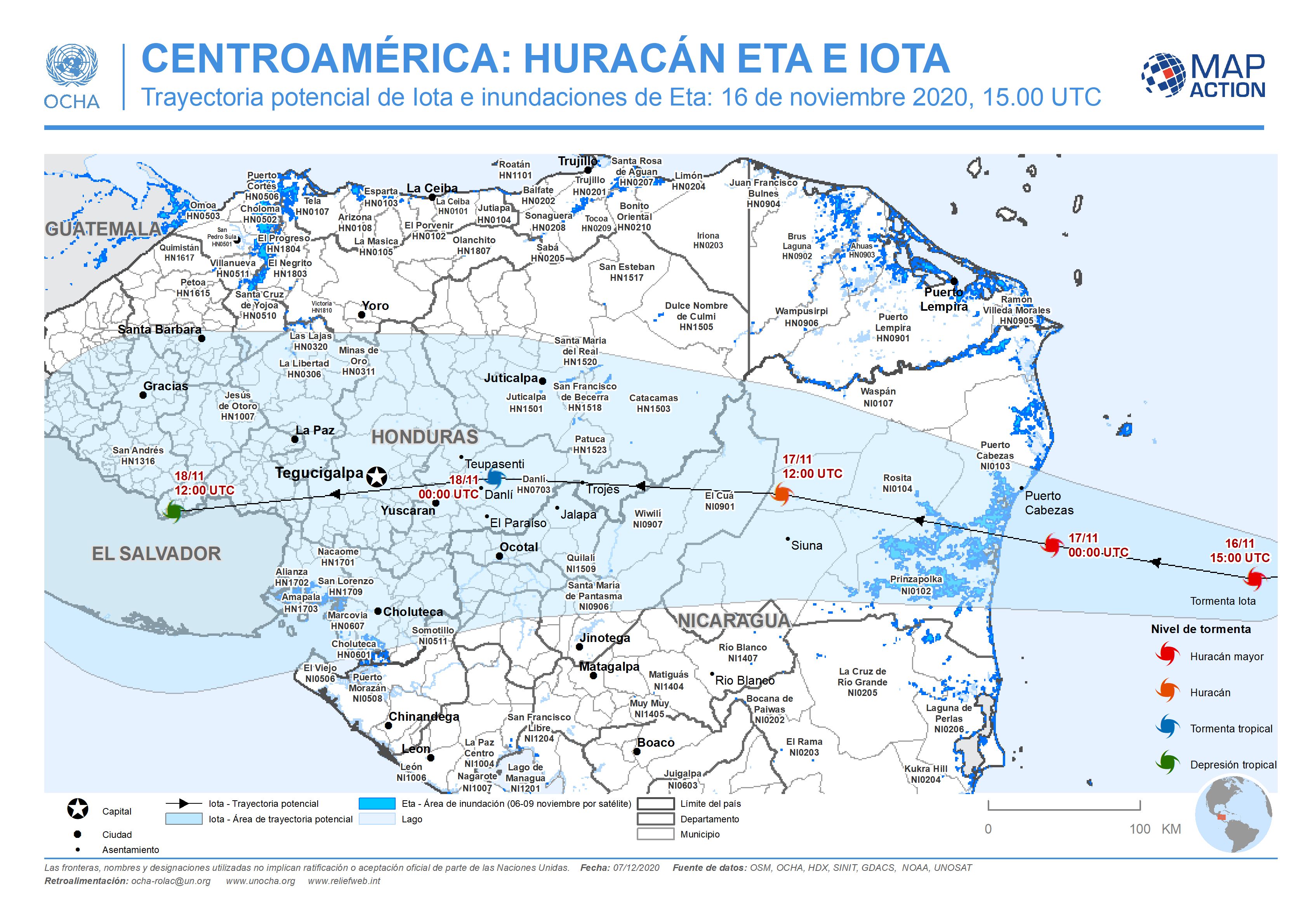
This map shows the affected administration level 2 municipalities for Nicaragua and Honduras by flooding from hurricane Eta, with predicted path and potential path cone for hurricane Iota.
Additional Information
| Field | Value |
|---|---|
| Data last updated | December 7, 2020 |
| Metadata last updated | December 7, 2020 |
| Created | December 7, 2020 |
| Format | JPEG |
| License | License not specified |
| Has views | True |
| Id | 0a2caf1a-9e61-4cda-83e1-513522b8f1c3 |
| Mimetype | image/jpeg |
| On same domain | True |
| Package id | adbf47bb-220d-46e1-af90-9e25460dadf2 |
| Revision id | c9e3f472-98b7-4649-9e53-620471d39826 |
| Size | 1 MiB |
| State | active |
| Url type | upload |