MA119_Honduras_Flood_exten_Land_cover_v01-300dp ...
From the dataset abstract
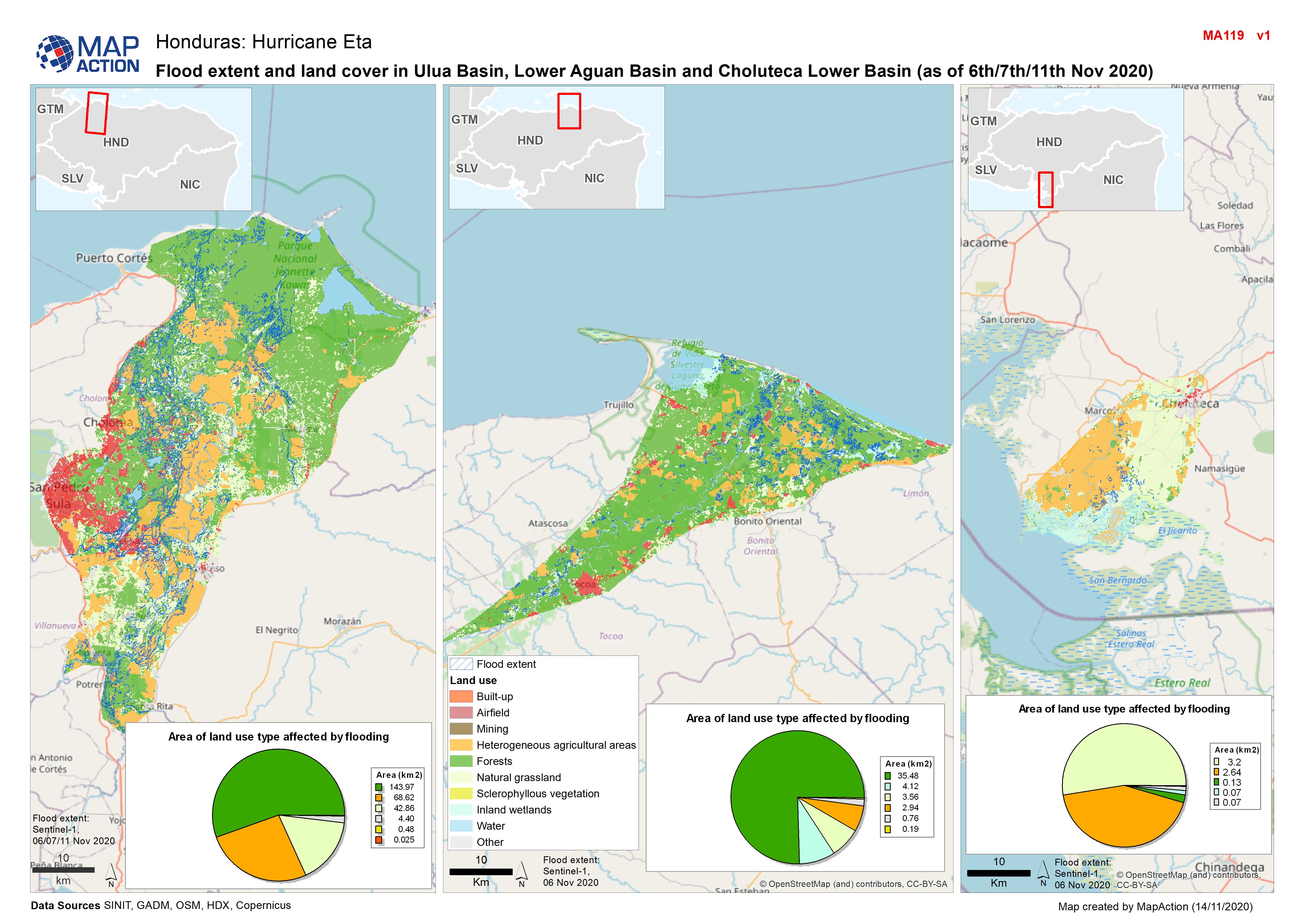
Map shows flood extents and land use in Ulua Basin, Lower Aguan Basin and Choluteca Lower Basin (as at 6th/11th Nov 2020)
Additional Information
| Field | Value |
|---|---|
| Data last updated | November 17, 2020 |
| Metadata last updated | November 17, 2020 |
| Created | November 17, 2020 |
| Format | JPEG |
| License | License not specified |
| Has views | True |
| Id | ef887d6a-67f8-4f89-9888-11dc13aa2e92 |
| Mimetype | image/jpeg |
| On same domain | True |
| Package id | 17cdf34d-7be5-4d5d-8be0-e7198a4ad897 |
| Revision id | 438f5be0-5734-4d6b-85c1-fe8df95f2774 |
| Size | 1.5 MiB |
| State | active |
| Url type | upload |