MA016D-LCA-TransportSectorDamage_MapBook-A3-v01 ...
From the dataset abstract
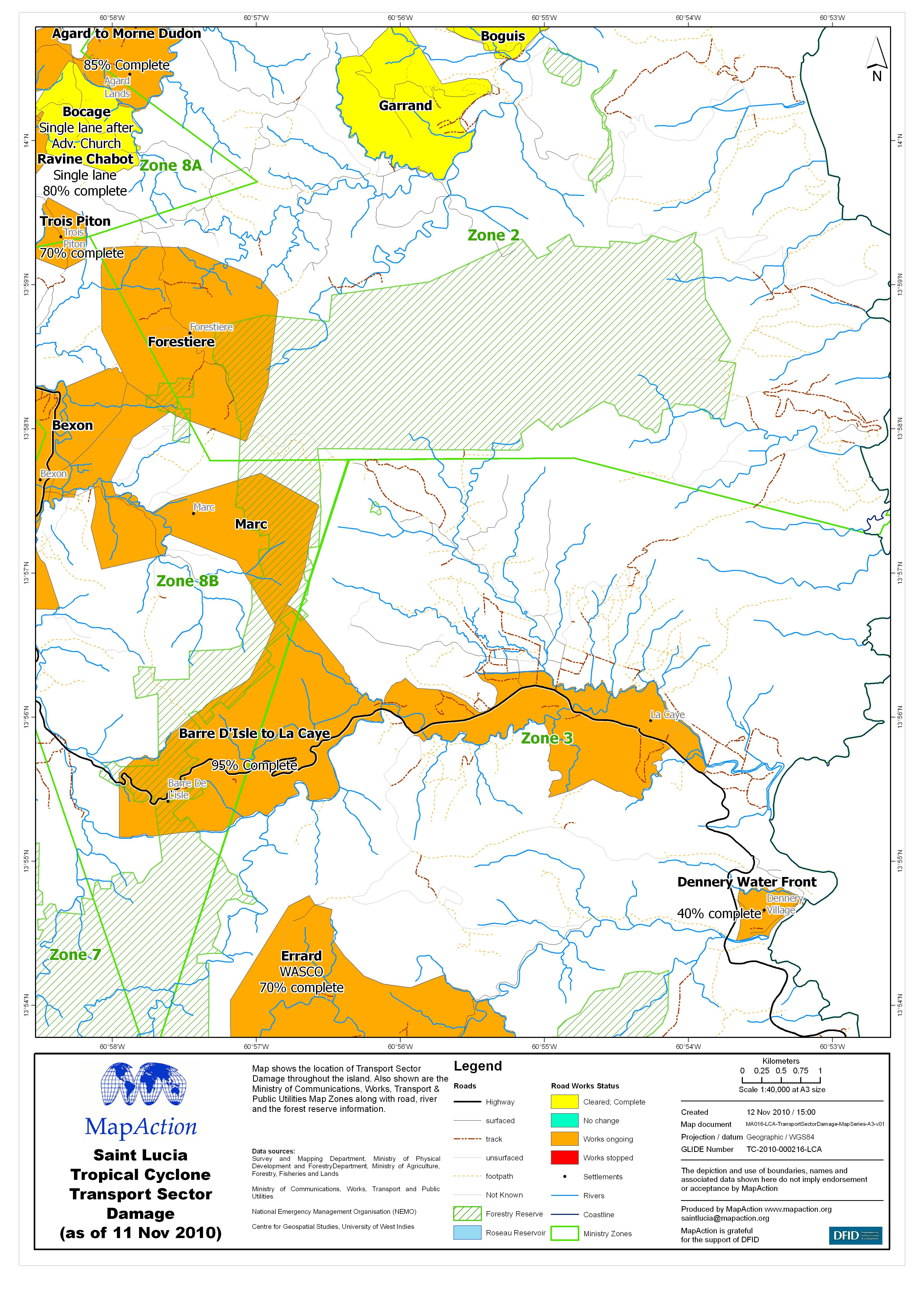
Map shows the location of Transport Sector Damage throughout the island. Also shown are the Ministry of Communications, Works, Transport & Public Utilities Map Zones along with road,...
Source: Saint Lucia Tropical Cyclone Transport Sector Damage (as of 11 Nov 2010) - Map MA016D
Additional Information
| Field | Value |
|---|---|
| Data last updated | July 4, 2016 |
| Metadata last updated | July 4, 2016 |
| Created | July 4, 2016 |
| Format | JPEG |
| License | License not specified |
| Has views | True |
| Id | 6a557814-8c50-4fc4-92b6-c4c8b580f2bd |
| On same domain | True |
| Package id | 5be679e5-369a-44b3-a4b1-99e55a359b48 |
| Revision id | ae062908-3470-479f-a2fc-c0feac78cf2e |
| State | active |
| Url type | upload |