MA016C-LCA-TransportSectorDamage_MapBook-A3-v01 ...
From the dataset abstract
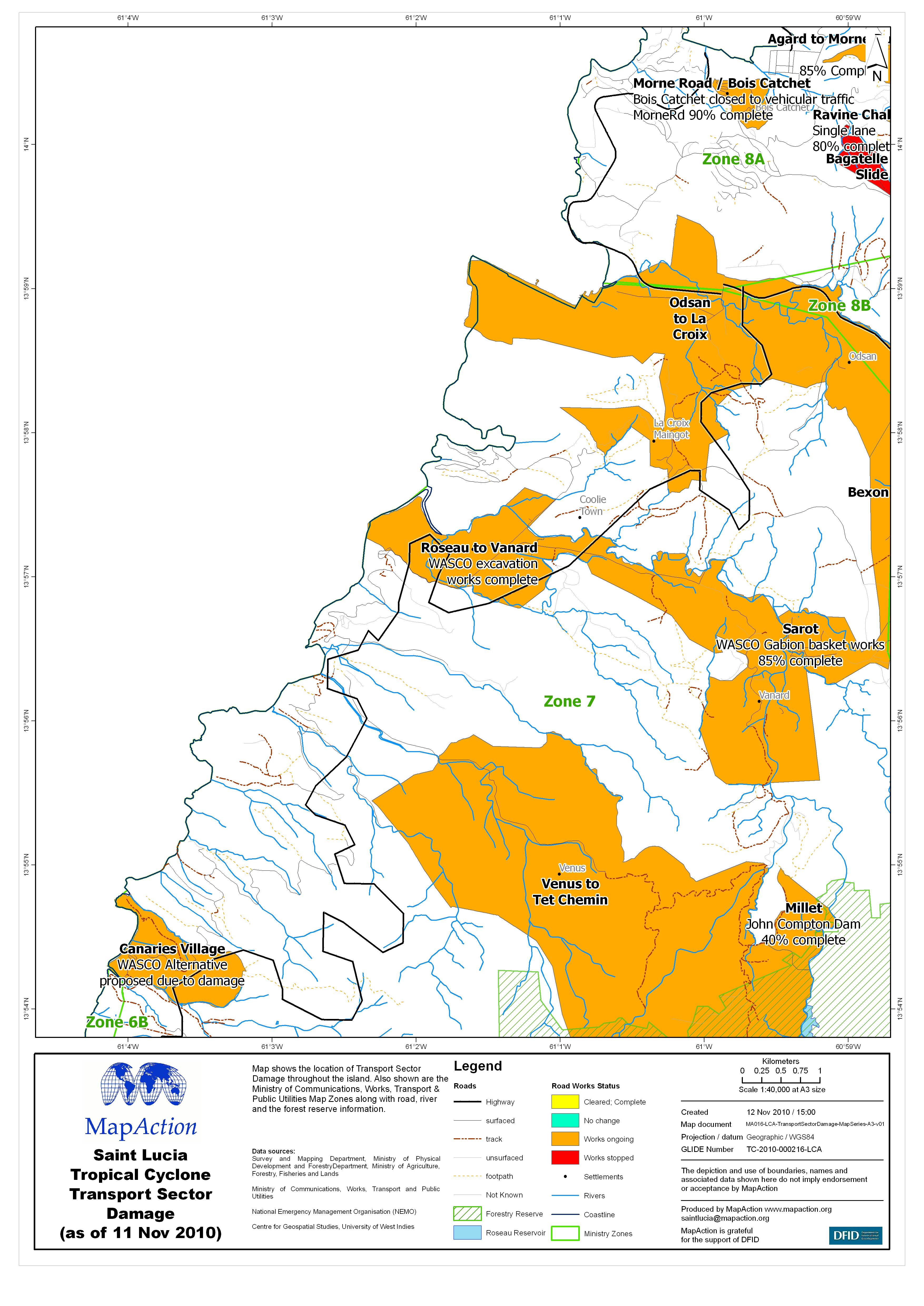
Map shows the location of Transport Sector Damage throughout the island. Also shown are the Ministry of Communications, Works, Transport & Public Utilities Map Zones along with road,...
Source: Saint Lucia Tropical Cyclone Transport Sector Damage (as of 11 Nov 2010) - Map MA016C
Additional Information
| Field | Value |
|---|---|
| Data last updated | July 4, 2016 |
| Metadata last updated | July 4, 2016 |
| Created | July 4, 2016 |
| Format | JPEG |
| License | License not specified |
| Has views | True |
| Id | 1b33c296-49e3-450c-a50c-f84e00ba9d4b |
| On same domain | True |
| Package id | b668043c-e900-4138-b582-e4002346bc16 |
| Revision id | c2230072-b6d5-443c-ad86-867f1f8d8927 |
| State | active |
| Url type | upload |