thumbnail.png
From the dataset abstract
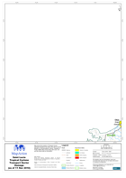
Map shows the location of Transport Sector Damage throughout the island. Also shown are the Ministry of Communications, Works, Transport & Public Utilities Map Zones along with road,...
Source: Saint Lucia Tropical Cyclone Transport Sector Damage (as of 11 Nov 2010) - Map MA016A
Additional Information
| Field | Value |
|---|---|
| Data last updated | July 28, 2016 |
| Metadata last updated | July 28, 2016 |
| Created | July 28, 2016 |
| Format | PNG |
| License | License not specified |
| Has views | True |
| Id | 0560f3aa-2eb6-4828-8aee-5cc922b33c92 |
| On same domain | True |
| Package id | d7848fda-ba7c-4819-a782-76b9a9c91af1 |
| Position | 2 |
| Revision id | eeb490c2-48e7-4fc5-9ee4-8e08eb584f65 |
| State | active |
| Url type | upload |