MA001-LCA-SituationOverview-A3-v02-300dpi.jpg
From the dataset abstract
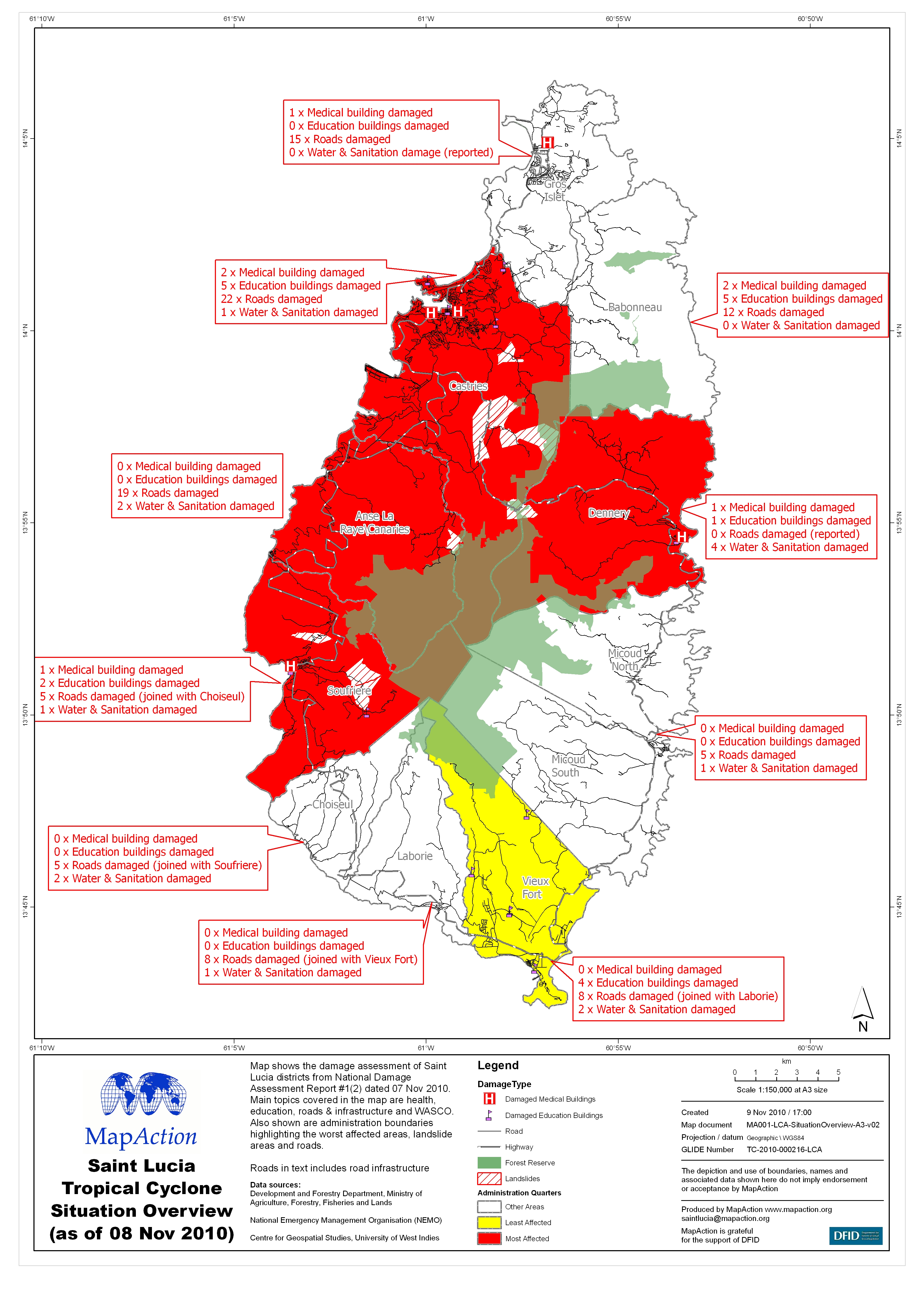
Map shows the damage assessment of Saint Lucia districts from National Damage Assessment Report #1(2) dated 07 Nov 2010. Main topics covered in the map are health,education, roads &...
Source: Saint Lucia Tropical Cyclone Situation Overview(as of 08 Nov 2010)
Additional Information
| Field | Value |
|---|---|
| Data last updated | July 4, 2016 |
| Metadata last updated | July 4, 2016 |
| Created | July 4, 2016 |
| Format | JPEG |
| License | License not specified |
| Has views | True |
| Id | f1467165-5731-478a-88ef-5665ab60b329 |
| On same domain | True |
| Package id | 663b18bc-fa8d-405b-a964-63b3b4d933c9 |
| Revision id | 8e36338f-6b49-437a-8a4c-9a58fd9273bf |
| State | active |
| Url type | upload |