thumbnail.png
From the dataset abstract
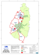
Map shows who, what, where information for agencies responding to the disaster. Information shown is only what is known to NEMO, if you would like to be added to the map please email:...
Source: Saint Lucia Tropical Cyclone Who, What, Where (as of 08 Nov 2010)
Additional Information
| Field | Value |
|---|---|
| Data last updated | July 28, 2016 |
| Metadata last updated | July 28, 2016 |
| Created | July 28, 2016 |
| Format | PNG |
| License | License not specified |
| Has views | True |
| Id | e4dbdf35-4053-499a-baf3-e2bb8ec04eb2 |
| On same domain | True |
| Package id | 272c469c-3be6-4162-a7a3-9f3a455b6e0e |
| Position | 2 |
| Revision id | 1308075b-1a78-4cc4-8823-8f86289577d1 |
| State | active |
| Url type | upload |