MA006-LCA-DenneryNS-Damage-A3-v01-300dpi.jpg
From the dataset abstract
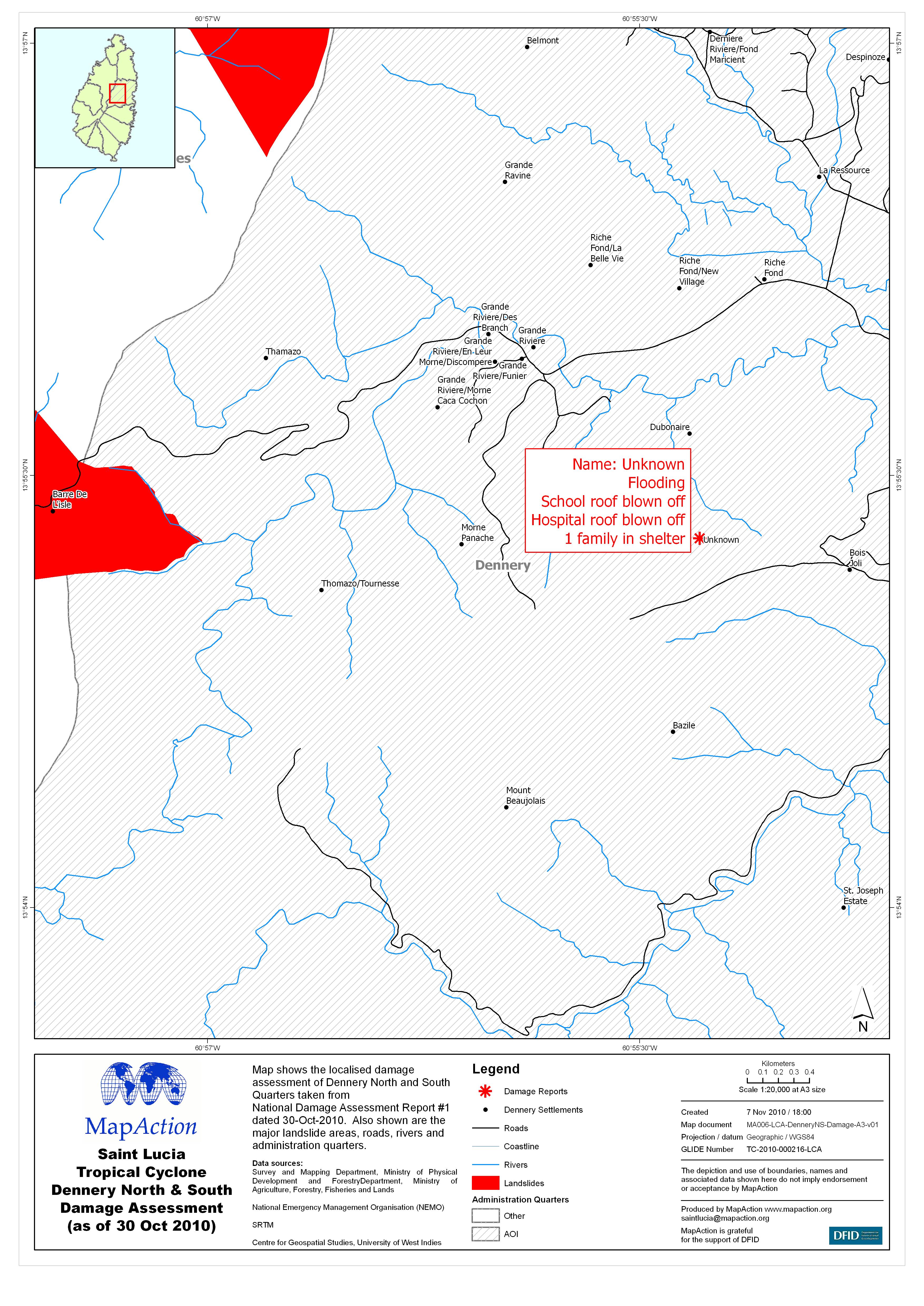
Map shows the localised damage assessment of Dennery North and South Quarters taken fromNational Damage Assessment Report #1 dated 30-Oct-2010. Also shown are the major landslide areas,...
Source: Saint Lucia Tropical Cyclone Dennery North & South Damage Assessment (as of 30 Oct 2010)
Additional Information
| Field | Value |
|---|---|
| Data last updated | July 4, 2016 |
| Metadata last updated | July 4, 2016 |
| Created | July 4, 2016 |
| Format | JPEG |
| License | License not specified |
| Has views | True |
| Id | 89eb9251-781d-4111-9f9b-6ccedcb56cf9 |
| On same domain | True |
| Package id | 33369fa3-e808-4467-bc91-1b74f48324dc |
| Revision id | acd5377f-04f0-4129-824d-df8f8122fb99 |
| State | active |
| Url type | upload |