PAK263_Pakistan_Floods_Overview_v13_A0_06092010 ...
From the dataset abstract
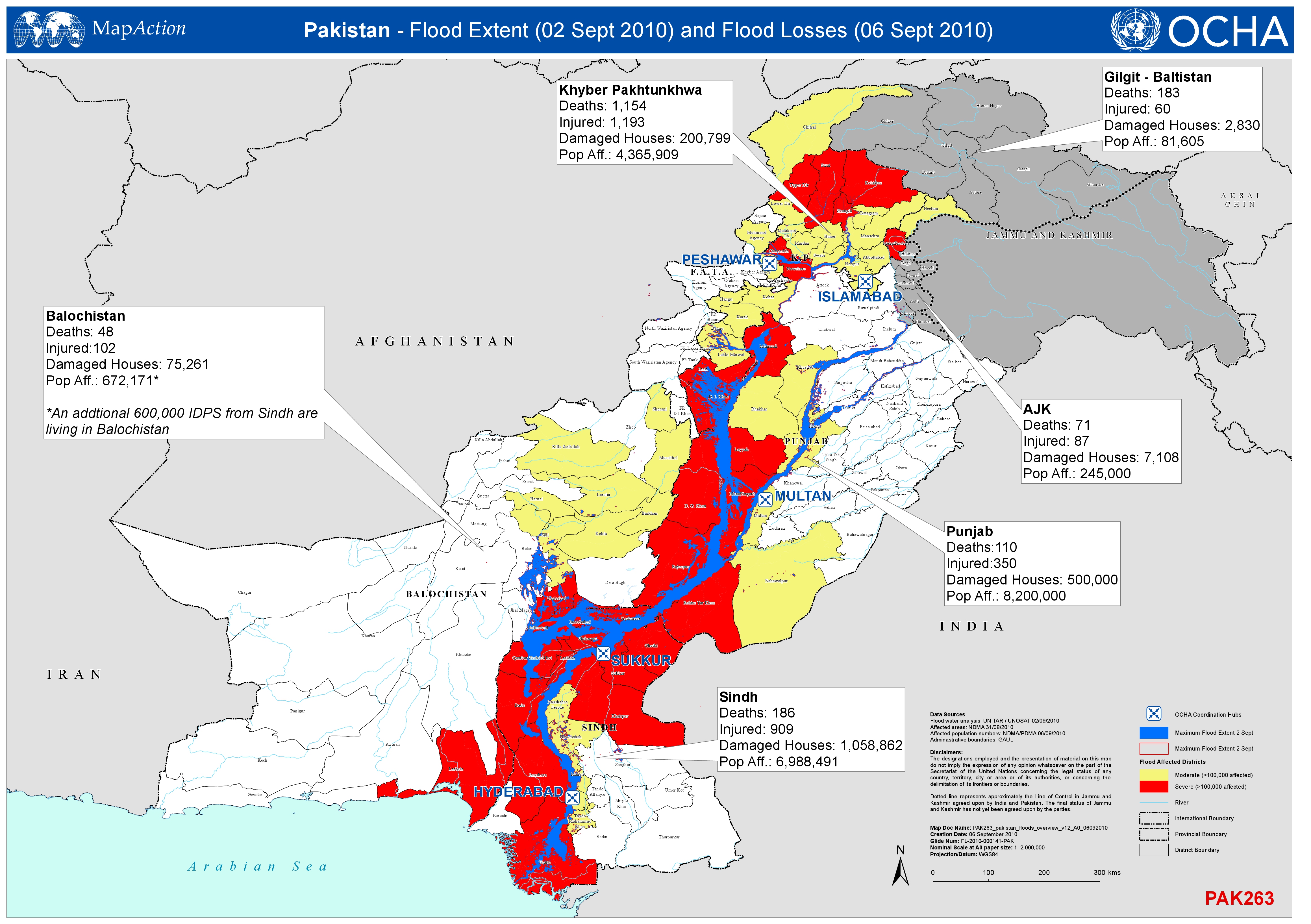
Shows the extent of the flood (2nd Sept 2010) and the numbers of deaths, injured persons, damaged houses and affected population by Province ( 6th Sept 2010).
Source: Pakistan - Flood Extent (2 Sept 2010) and Flood Losses (6 Sept 2010)
Additional Information
| Field | Value |
|---|---|
| Data last updated | July 4, 2016 |
| Metadata last updated | July 4, 2016 |
| Created | July 4, 2016 |
| Format | JPEG |
| License | License not specified |
| Has views | True |
| Id | 32cd8e13-2df3-450a-b66d-fc6e59a60ae0 |
| On same domain | True |
| Package id | 35b719ba-584f-4a2c-bfde-194ab4fe63ef |
| Revision id | 0fa80539-035e-4f2c-86e3-f37f3917c2aa |
| State | active |
| Url type | upload |