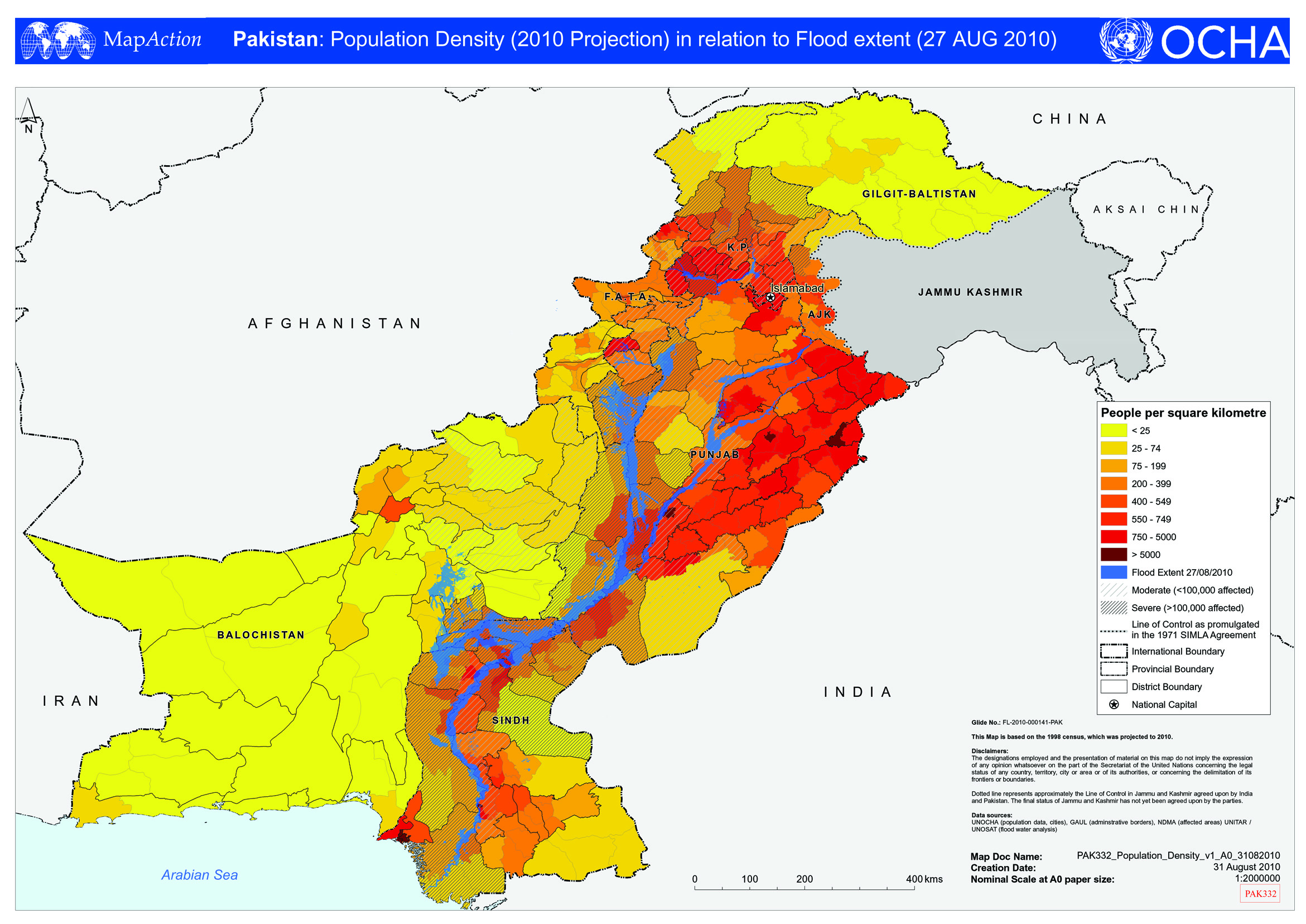
PAK332_Population_Density_v1_A0_31082010.jpg
From the dataset abstract
Map shows population density at district level relative to the flood extent as determined on 27 August 2010.
Source: Pakistan: Population Density (2010 Projection) in relation to Flood extent (27 AUG 2010)
Additional Information
| Field | Value |
|---|---|
| Data last updated | July 4, 2016 |
| Metadata last updated | July 4, 2016 |
| Created | July 4, 2016 |
| Format | JPEG |
| License | License not specified |
| Has views | True |
| Id | a3ec1dd1-1a03-4751-a9e2-a1e3d37869b4 |
| On same domain | True |
| Package id | 5a76ffd1-f3ff-48a3-b1d9-d9c7095e394b |
| Revision id | abbf5821-c4d5-4db9-b6de-0651a50ebb36 |
| State | active |
| Url type | upload |
