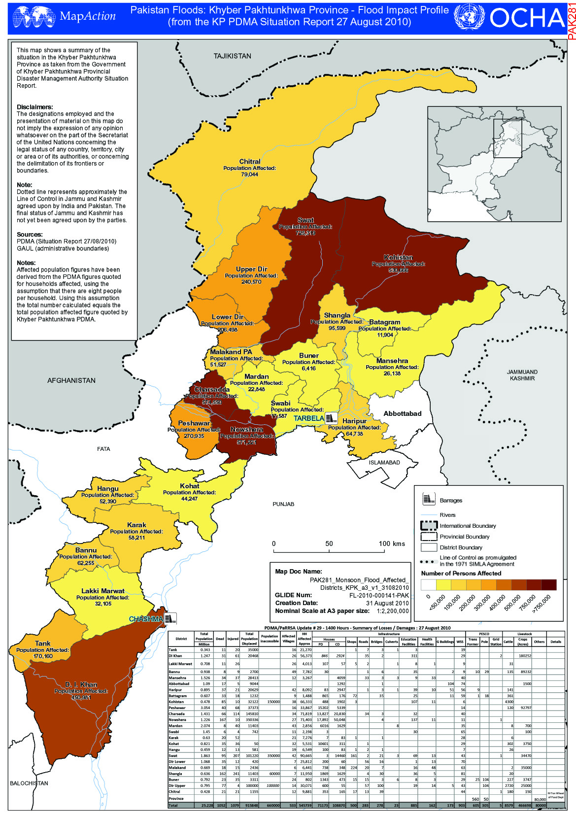
PAK281_Monsoon_Flood_Affected_Districts_KPK_a3_ ...
From the dataset abstract
This map shows a summary of the situation in the Khyber Pakhtunkhwa Province as taken from the Government of Khyber Pakhtunkhwa Provincial Disaster Management Authority Situation Report.
Additional Information
| Field | Value |
|---|---|
| Data last updated | July 4, 2016 |
| Metadata last updated | July 4, 2016 |
| Created | July 4, 2016 |
| Format | JPEG |
| License | License not specified |
| Has views | True |
| Id | f8e5ad84-5001-46ae-a444-903a6ba427bf |
| On same domain | True |
| Package id | df962443-b466-436c-8439-59a451ebca29 |
| Revision id | 98e90ec0-9f43-4e9f-a073-7c6528a0ad72 |
| State | active |
| Url type | upload |
