SAFER_A1_Mapsheet_Overview-Map_T36_V2_75pc.jpg
From the dataset abstract
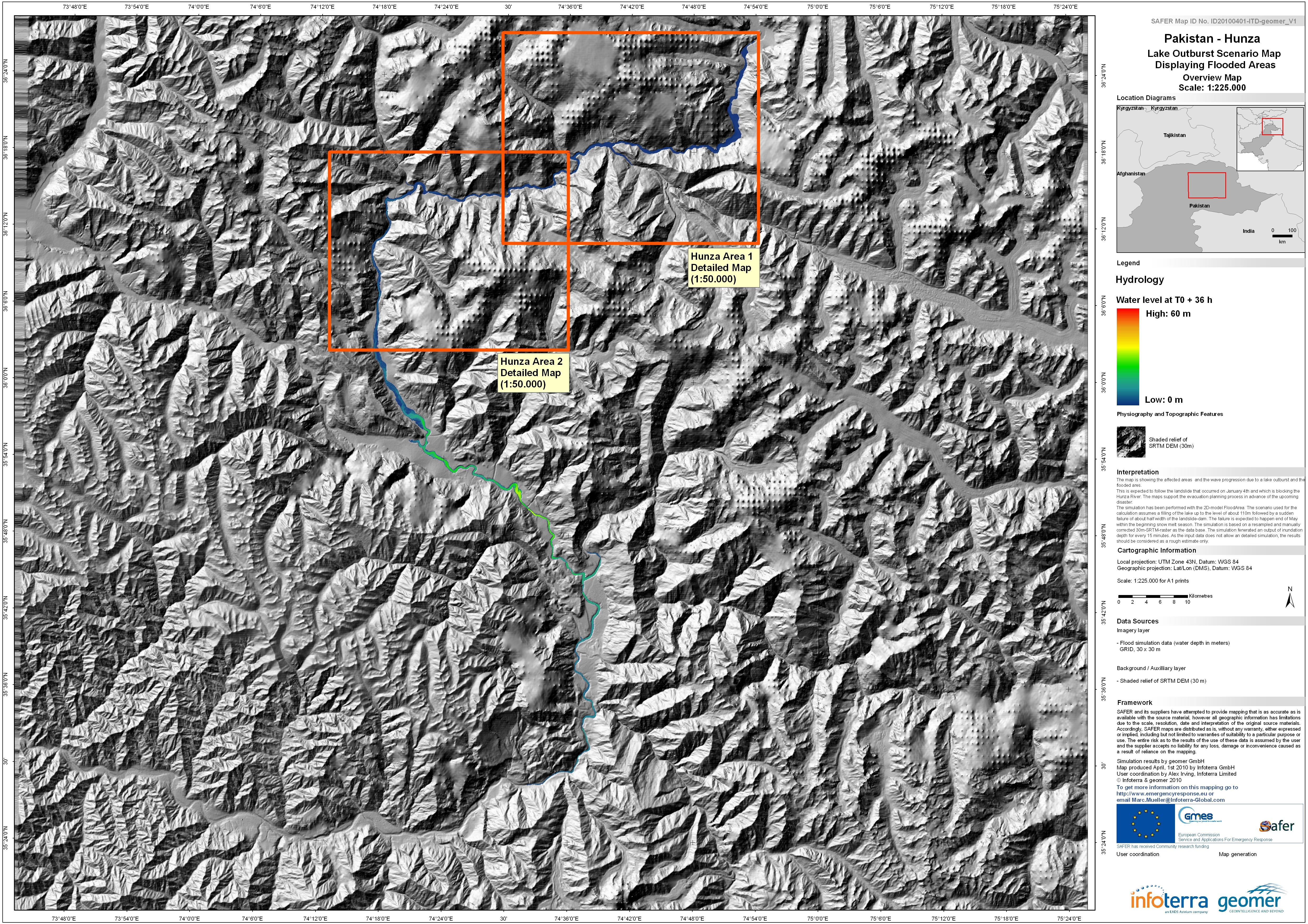
The map indicates possible water depth, in metres, in the event of a catastrophic failure of the landslide dam formed in the Hunza river valley in early January 2010. It is one of a...
Source: Pakistan - Hunza: Lake Outburst Scenario, Overview, Time T0+36hours
Additional Information
| Field | Value |
|---|---|
| Data last updated | July 4, 2016 |
| Metadata last updated | July 4, 2016 |
| Created | July 4, 2016 |
| Format | JPEG |
| License | License not specified |
| Has views | True |
| Id | fe586859-3277-43bc-81c1-8288cdbd2e2a |
| On same domain | True |
| Package id | 22c44a7c-2582-4d8e-807d-f602ef21a8af |
| Revision id | 85f85216-3a7d-421b-8cf2-aa056f5dd480 |
| State | active |
| Url type | upload |