SAFER_A1_Mapsheet_Situationmap_Area1_T42_V2_75p ...
From the dataset abstract
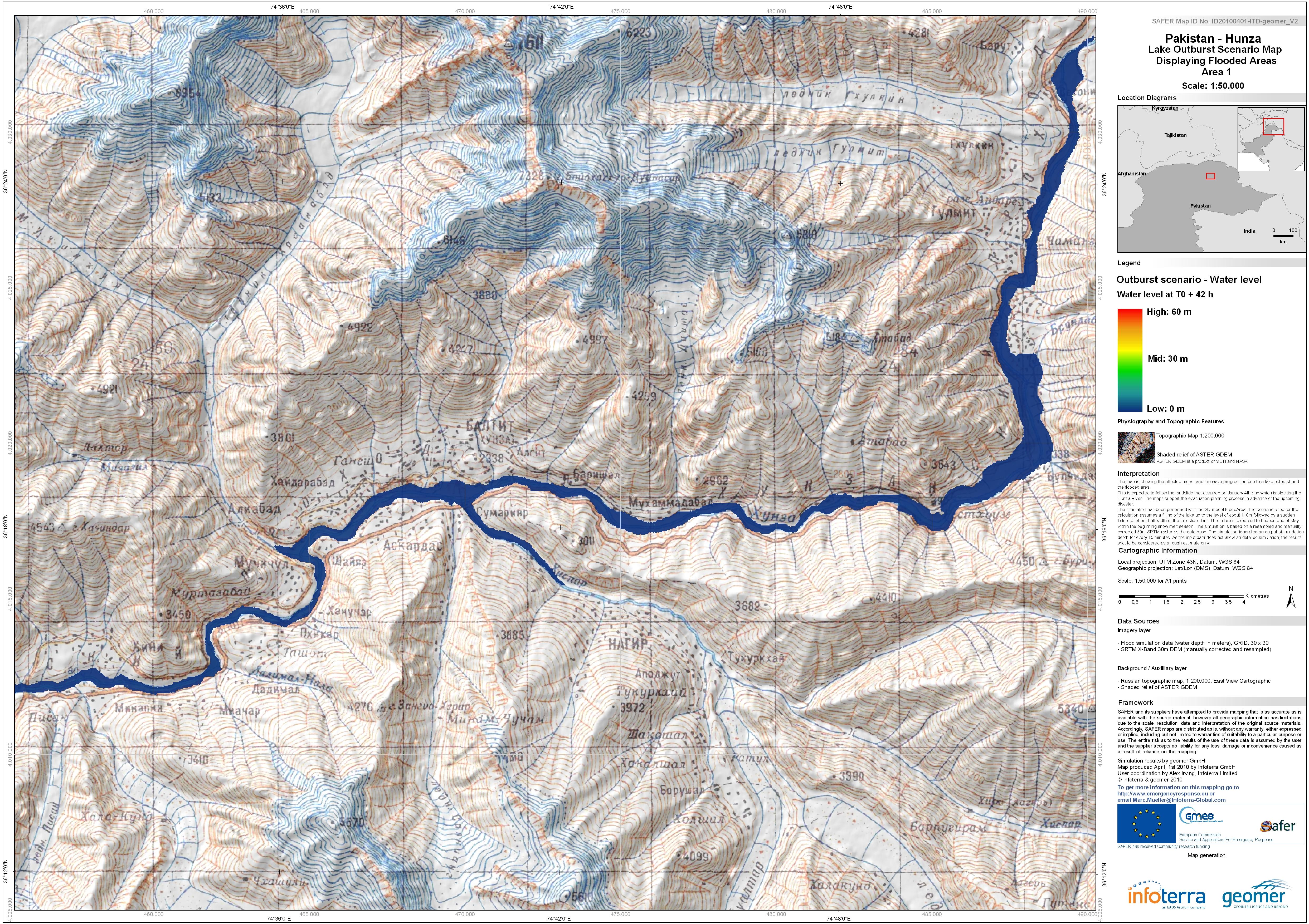
The map is showing the affected areas and the wave progression due to a lake outburst and flooded area.This is expected to follow the landslide that occured on January 4th and which is...
Source: Pakistan - Hunza: Lake Outburst Scenario Map Displaying Flooded Areas. Area 1. T+42.
Additional Information
| Field | Value |
|---|---|
| Data last updated | July 4, 2016 |
| Metadata last updated | July 4, 2016 |
| Created | July 4, 2016 |
| Format | JPEG |
| License | License not specified |
| Has views | True |
| Id | 67eb12e5-853d-4dd4-8c14-bda9626f9510 |
| On same domain | True |
| Package id | 12436b38-53c6-41c5-b6c6-fe4c6e35f281 |
| Revision id | 10682f60-ddc3-4693-8c7f-887f0b3ecef5 |
| State | active |
| Url type | upload |