MA119_hti_cityblock_damage_17Jan_A3-300dpi.jpg
From the dataset abstract
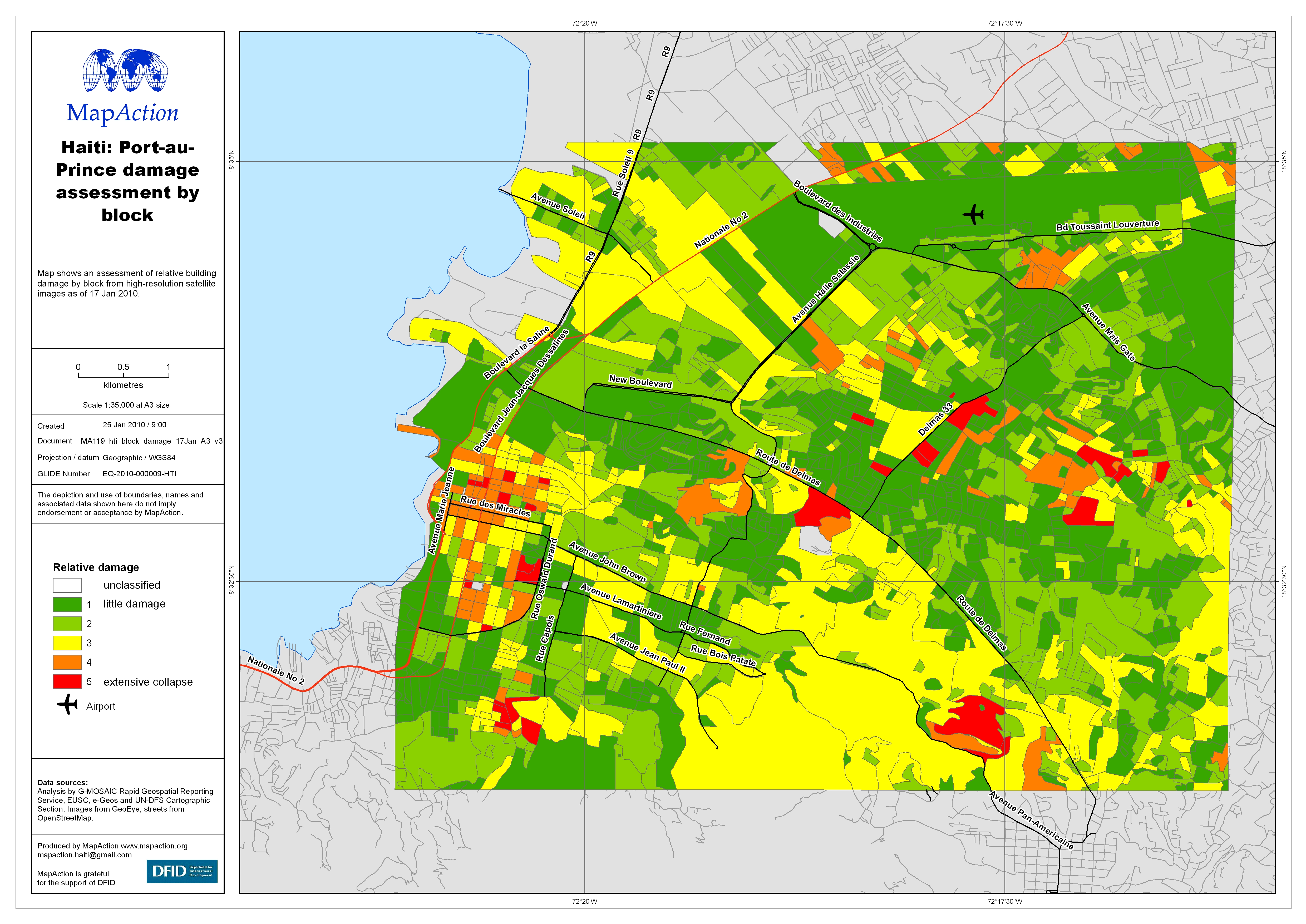
Map shows an assessment of relative building damage by block from high-resolution satellite images as of 17 Jan 2010.
Additional Information
| Field | Value |
|---|---|
| Data last updated | July 4, 2016 |
| Metadata last updated | July 4, 2016 |
| Created | July 4, 2016 |
| Format | JPEG |
| License | License not specified |
| Has views | True |
| Id | 19d96f8c-bb54-477b-8f8d-6247498c9a24 |
| On same domain | True |
| Package id | 7cdc3b39-31f1-4445-b0a2-aa935e88b05f |
| Revision id | 4db977b3-ed52-4a96-9a4a-df25f669263c |
| State | active |
| Url type | upload |
