thumbnail.png
From the dataset abstract
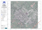
General map of Léogâne town, with some street names, for navigation, locating potential sites, and other humanitarian activities.
Source: Haiti: Léogâne Street Map
Additional Information
| Field | Value |
|---|---|
| Data last updated | July 28, 2016 |
| Metadata last updated | July 28, 2016 |
| Created | July 28, 2016 |
| Format | PNG |
| License | License not specified |
| Has views | True |
| Id | f05293ef-19ef-4559-8dd4-9201bb844c87 |
| On same domain | True |
| Package id | 493aabd1-9f60-49f2-a0d6-710a0aa145c9 |
| Position | 3 |
| Revision id | 91a5362d-43cf-4c21-af22-84f44f340ca3 |
| State | active |
| Url type | upload |